Geology is usually a quiet science, we generally only hear about it when there’s been a big earthquake or volcano eruption and even then all that the news media talks about is the destruction that’s happened to both people and property. There’s very little discussion of what an earthquake or volcano is and how they relate to our planet as a whole. Today I’d like to discuss two stories about our Earth that aren’t directly tied to either quakes or volcanoes and which don’t threaten destruction but which do tell us a great deal about the planet we live on.

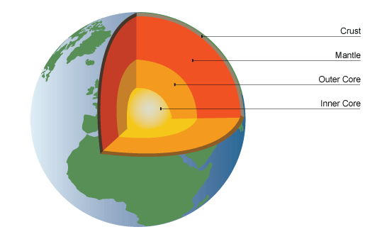
We all remember from our High School science classes how our planet is built. We learned that at Earth’s very center there is a solid metal inner core composed mostly of iron about the size of the planet Mars. Above this solid core is a liquid outer core of molten metal, again mostly iron, this liquid outer core being about a thousand kilometers thick. On top of the outer core rides the 2,900 kilometer thick Mantel which is composed of a mixture of metals and silicates and which is often described as being plastic because it’s too warm to be solid but not hot enough to be completely liquid. Finally at the top is the 10-20 kilometer thick crust of solid rock that all life exists upon. That’s the basic model we all learned in school.
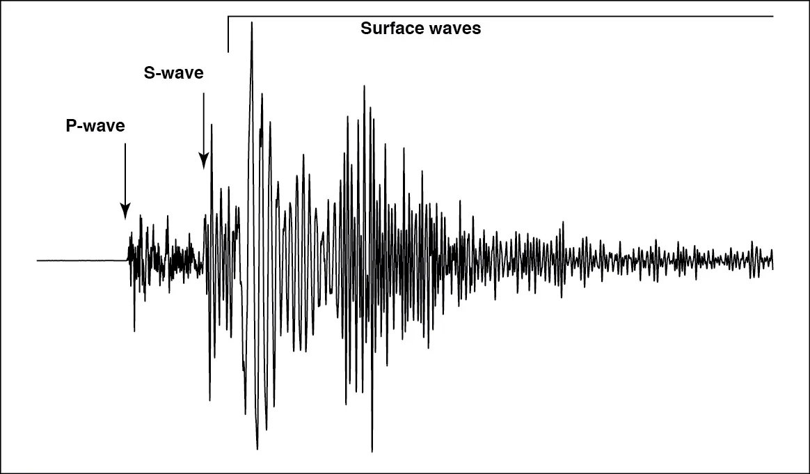
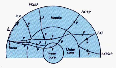
The way that scientists know that’s what the inside of Earth is like is by studying the different kinds of waves that are generated by large earthquakes or volcanic eruptions and which propagate around the entire planet. For example what geologists call a secondary or s wave is what physicists like me call a transverse wave, the kind of wave you can make with a piece of rope. Now transverse waves, s waves cannot go through either a liquid or a gas, they need a solid media to transmit them. So, if a large earthquake occurs in let’s say the island of Java in Indonesia then geologists at the exact opposite spot on Earth in Ecuador would not observe any s waves from that event because the s waves cannot pass through the liquid inner core.
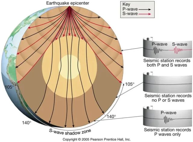
On the other hand earthquakes also generate primary or p waves that are like sound waves and which can go through a liquid so the scientists in Ecuador will see p waves from the quake on Java. It’s by studying the various ways that the waves generated by Earthquakes propagate that geologists have learned so much about the interior of our planet.
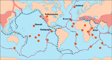
Now a new study is linking a mysterious kind of seismic wave called a PKP precursors with another mystery, volcanic ‘hot spots’ which are volcanoes that seem to last for hundreds of millions of years at the same spot on Earth even as the continental plates move across the top of them. The Hawaiian Island chain is the best know example of this, a fixed volcano ‘hot spot’ that has created a series of islands as the Pacific plate moved across it. The supervolcano beneath Yellowstone Park is another such long lasting ‘Hot Spot’.
Geologists studying the PKP precursor waves at the University of Utah recognized that they were not being directly generated by earthquakes, instead PKP waves appeared to be echoes, that is waves that were bouncing off of something deep underground and are then scattered in many different direction. Now the Utah geologists have succeeded in zeroing in on the locations where PKP waves originate and have discovered that they are clustered around the volcanic hot spots in the Pacific, North America and Iceland.
Based upon what the researchers can learn about these deep regions in the Earth’s mantel they have been christened ‘Ultra Low Velocity Zones’ (ULVZs) and appear to lay at the boundary between Earth’s mantel and liquid core. Exactly what connection these ULVZs have with the volcanic hot spots is unknown at present, do they cause the hot spots or do the hot spots attract the ULVZs? You can be certain however that geologists will concentrate their efforts to further understand the origins of PKP waves at the ULVZs.
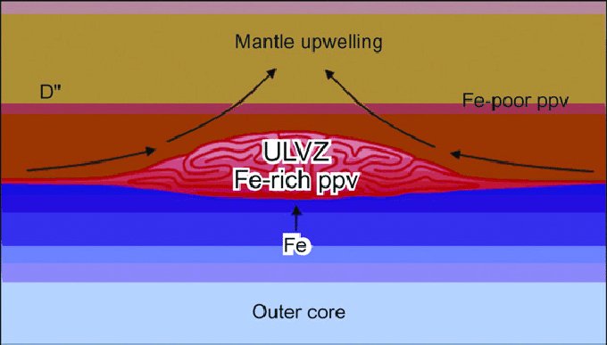
As I was writing about the paper describing the discovery of the Ultra Low Velocity Zones (ULVZs) by the geologists at the University of Utah a second paper was being prepared by a second group of geologists at the Australian National University that provides further details about the ULVZs. According to the Australians the ULVZs form a doughnut shaped structure roughly beneath the equator at the boundary between the inner core and the mantel. Now the precise details about the ULVZs differ slightly between the two papers but it’s exciting to watch as a new part of our planet is being discovered and explored.
Even while they study our planet’s interior geologists also continue to learn more and more about Earth’s past. Throughout it’s history Earth has seen periods of large temperature swings that resulted in geological periods where the planet became so hot that it completely lost its polar ice caps as well as periods where the planet was so cold that they have been christened ‘ice ages’.
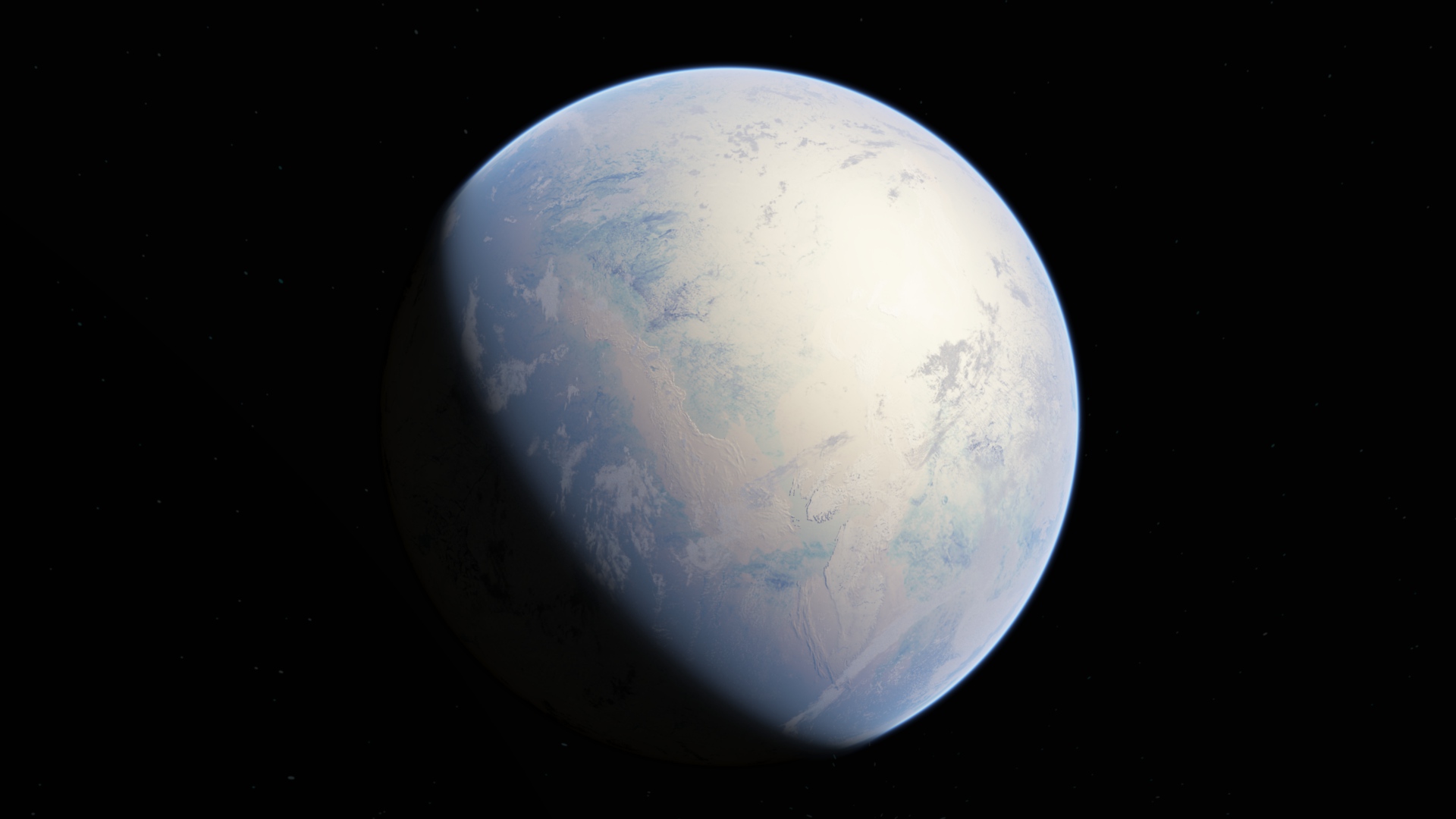
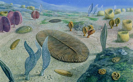
One of the most extreme cold periods occurred between 720 and 660 million years ago and is known as ‘Snowball Earth’ because virtually the entire planet’s surface was covered in ice. This particular ice age is of considerable importance not only because it was so extreme but because the first evidence for multi-cellular life occurs in the fossil record immediately after Snowball Earth. In fact evolutionary biologists have developed the theory that multi-cellular life evolved in order to survive the extremely harsh conditions of Snowball Earth and then exploded around the world as the glaciers retreated.
The problem for both geologists and biologists is that ice ages have a tendency to destroy the geologic evidence of their own existence by the grinding and scouring of glaciers across the planet’s surface. For over a hundred years geologists have been searching for an unbroken stretch of sedimentary rock that records the entire history of Snowball Earth.
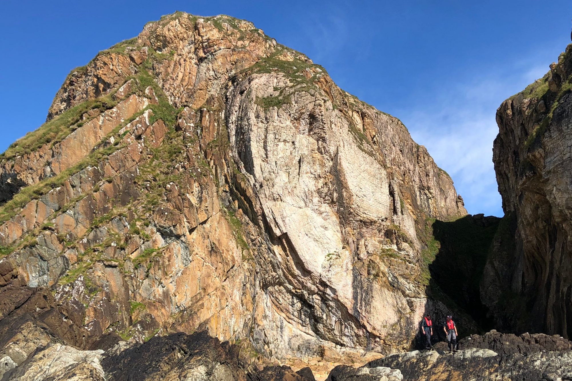
They may now have finally found it. A new study in the Journal of the Geological Society of London by geologists at the University College of London has found that the Port Askaig formation on the Hebrides Islands of Scotland along with portions of Northern Ireland is just that rock sequence. The Port Askaig formation is a 1.1 kilometer thick series of strata that were laid down as sedimentary rock during the Sturtian glaciation period, to give Snowball Earth is technical name and which are underlain by 70 meters of carbonate rock that formed in tropical waters. Which shows that the period right before the snowball was considerably warmer. Those carbonate rocks are teeming with cyanobacteria, the most common form of life on the early Earth.

The islands of the Inner Hebrides are generally uninhabited, making the Port Askaig formation a perfect labouratory for geologists to study this critical period in Earth’s history. Perhaps somewhere in these Scottish rocks lies the secret to the environmental conditions that caused the single celled life of Earth to unite into the communities of cells that today we call plants and animals.