Over this summer of 2018 Climate Change has brought extreme weather conditions to many of the regions of Europe. In both Portugal and Southern France monsoon-like rains have caused widespread flooding while areas to the north have seen droughts more severe than any in recorded history. England in particular is suffering from an almost complete lack of rain.
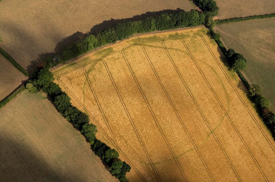
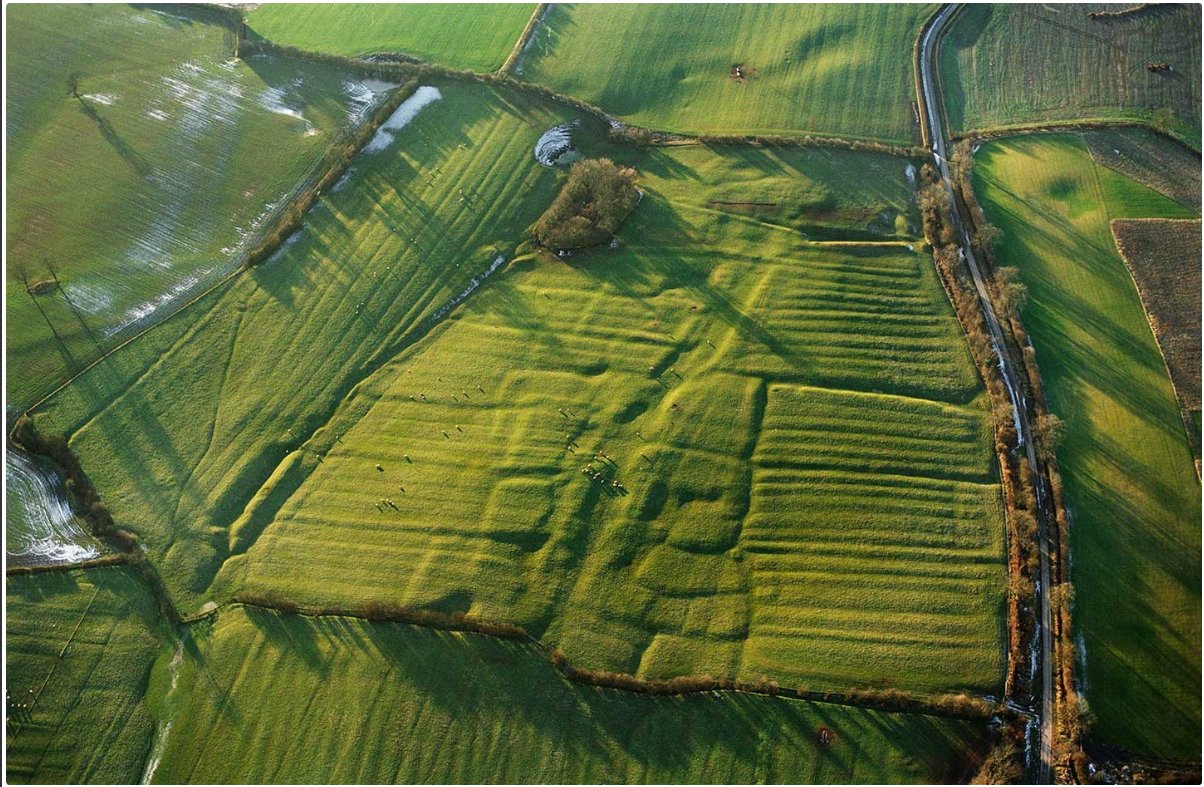
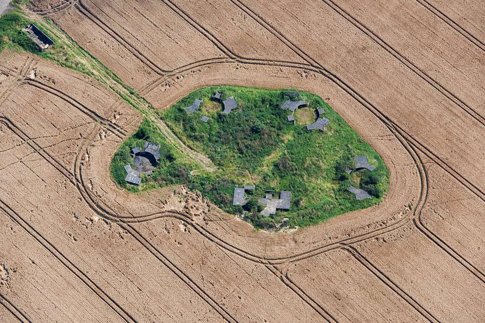
But every cloud has a silver lining they say (weather pun intended) and in England archeologists have been making the best of the situation by rediscovering hundreds of ancient homesteads, villages, hillforts and other sites, from the air! Flying over the parched, brown grasses of the English countryside ghostly lines known as cropmarks become visible appearing to trace the outlines of long vanished human habitation. See images below.
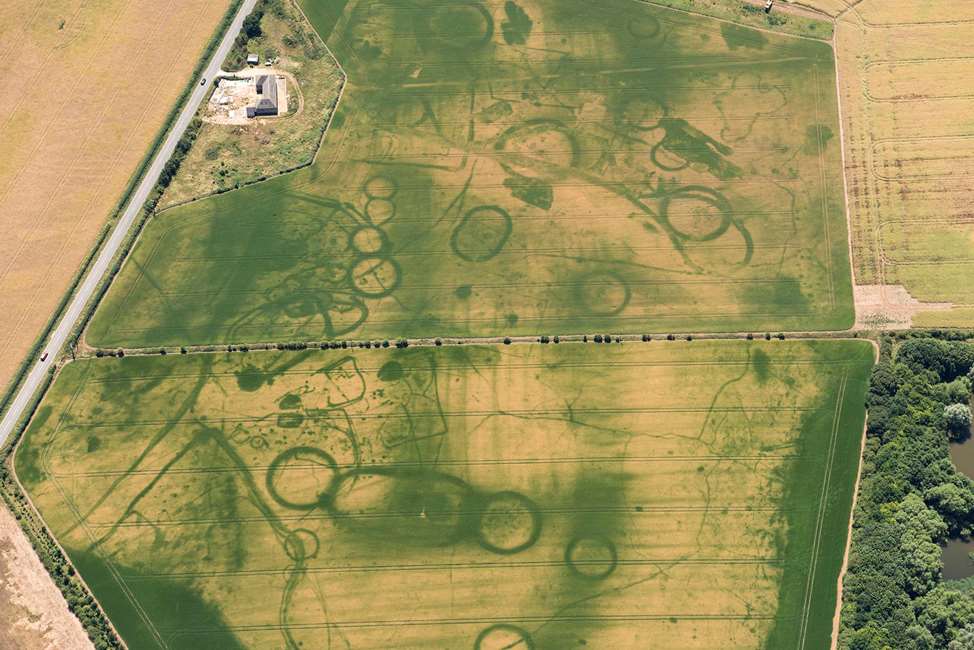
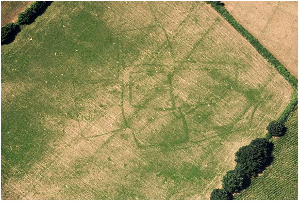
It’s hard to imagine how a buried stonewall or even a ditch that was filled in long ago could still effect the plants that are now growing above them. However even tiny chemical differences in the soil can show up as a slight variation in plant colour under the right conditions, such as a drought. These differences may be almost imperceptible from the ground but from the air…well the images speak for themselves. According to Historic England’s Chief Executive Duncan Wilson, “This spell of very hot weather has provided the perfect conditions for our aerial archeologists to ‘see beneath the soil’ as cropmarks are much better defined when the soil has less moisture.”
Damian Grady, the Manager of Aerial Reconnaissance for Historic England agrees adding, “This has been one of my busiest summers in 20 years of flying and it has been very rewarding making discoveries in areas that do not normally reveal cropmarks”. By the way, just last year the Aerial Reconnaissance branch of Historic England celebrated it’s 50th birthday.
Aerial Reconnaissance is becoming one of the most important tools in the field of archeology with good reason. Trying to find Iron Age or older farm sites by exploratory digging is both expensive, time consuming and can often come up empty handed. On the other hand, a pleasant afternoon’s flight in a small plane with a camera can disclose the exact location of dozens potential areas worth excavating.
While England is at present one of the leading countries for aerial archeology the Middle East and even South America are also using the technique to great effect, rediscovering sites lost to mainstream history. (See my post of April 4th 2018.) There are still large areas of the world remaining to be surveyed from the air however. The great steppes of Russia and central Asia have been inhabited for tens of thousands of years and we know very little about the people and cultures that arose there. Aerial reconnaissance could cover those seemingly endless square kilometers of grassland and potentially discover hundreds of places to excavate and study.
Even while they are excited to be making all of these wonderful discoveries the archeologists at Historic England know that their good luck has come at the expense of all of the farmers whose crops are withering from a lack of rain. Another example of how Climate Change may very well bring some benefits to a small percentage of the human race, even as it brings ruin to the lives of many.
If you’d like to know more about Historic England’s aerial reconnaissance of if you’d just like to see some more of these fascinating images click on one of the links below to be taken to their website.
https://historicengland.org.uk/whats-new/research/50-years-flying/
https://historicengland.org.uk/whats-new/news/hot-dry-summer-reveals-hidden-archaeological-sites