
Just a few weeks ago, 11August 2021, I published a post describing the massive flooding that had hit the cities of Zhengzhou in central China and London in the UK. The rainstorms that caused the flood events in both cities would have been considered to have been once in a thousand years deluges were it not for the way that climate change is making extreme weather much more common. In that post I wondered how the infrastructure in cities, especially older cities like London, were going to cope with ‘The New Normal’.
When I wrote that post I had no idea that I was soon to become a witness to the very predicament I had written about. That’s because, on the first of September 2021 the remnants of Hurricane Ida, the leftovers that is, unleashed its destructive power on my home state of Pennsylvania along with New Jersey and New York.
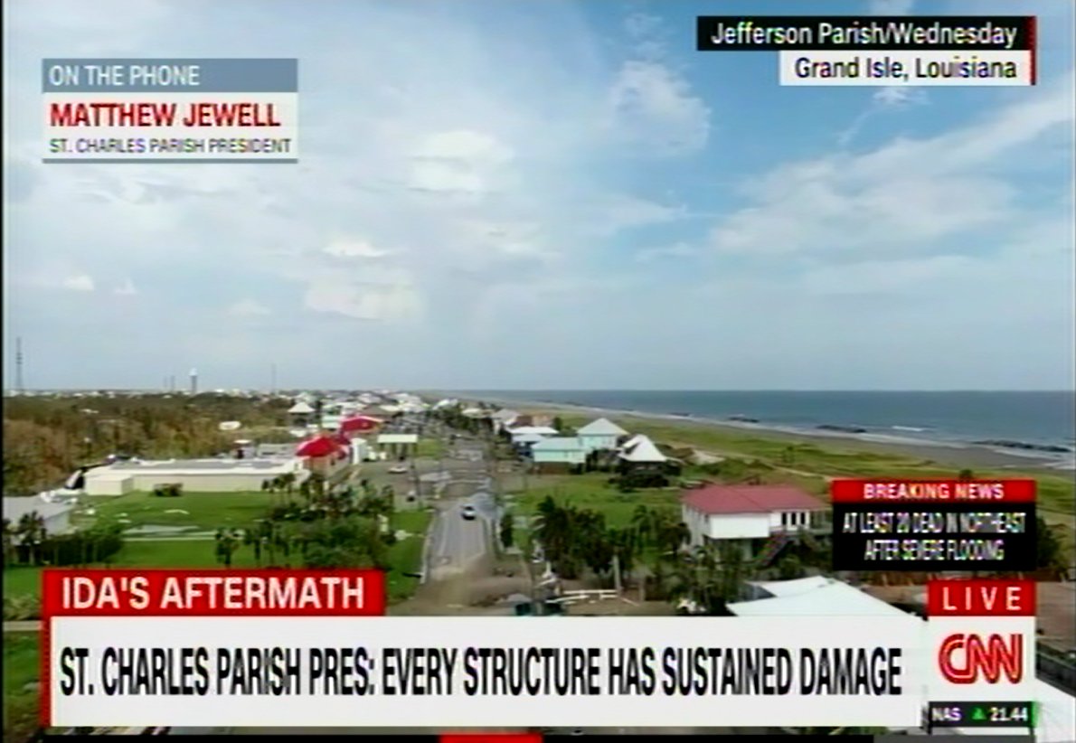
Now Ida had already caused more than enough damage to the state of Louisiana and southern Mississippi when it came ashore on the 29th of August, the 16th anniversary of Hurricane Katrina. The storm hit as a strong category 4 with winds over 240 kph causing terrific damage. Whole communities were destroyed with more than a dozen dead while over 1 million people lost their electrical power due to downed power lines and uprooted trees.
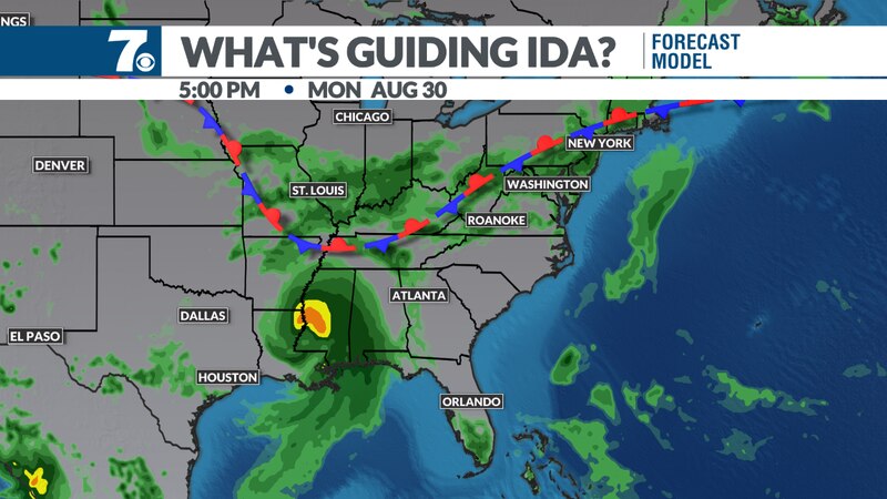
Turning to the northeast over the next several days Ida brought heavy rains to the states of Alabama, Tennessee, Kentucky West Virginia and Virginia before entering the Mid-Atlantic States. It was here that the now tropical depression collided with a cold front coming down from Canada. That front squeezed Ida like a sponge releasing its remaining moisture and causing the storm to regain some of her strength.
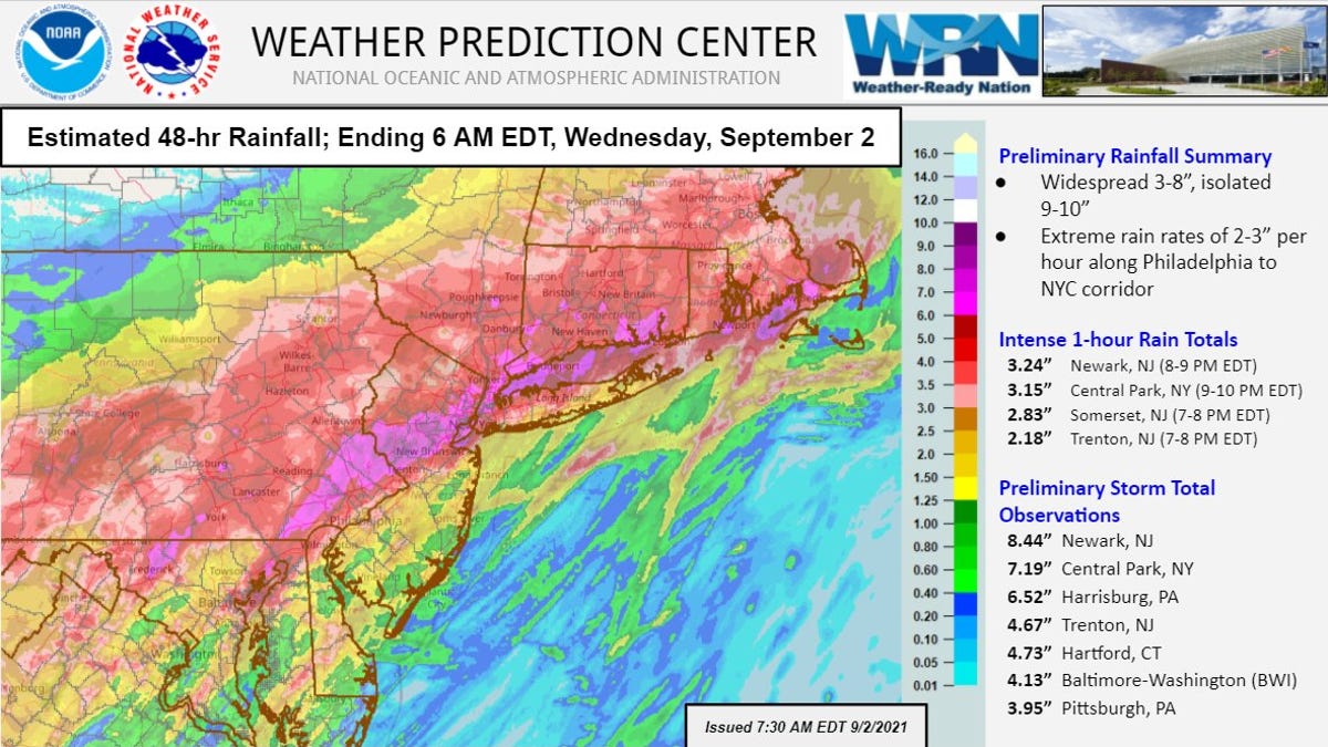
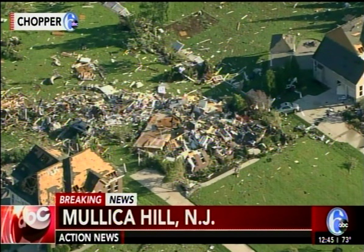
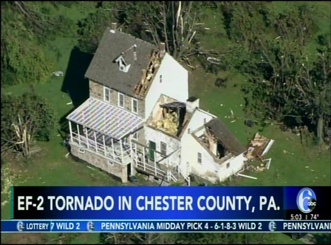
If you draw a line from Baltimore through Philadelphia to New York City to the northwest of that line there were historic amounts of rainfall that caused unprecedented flooding. To the southeast a series of supercell storms dropped strong tornadoes that ripped up trees and flattened homes.
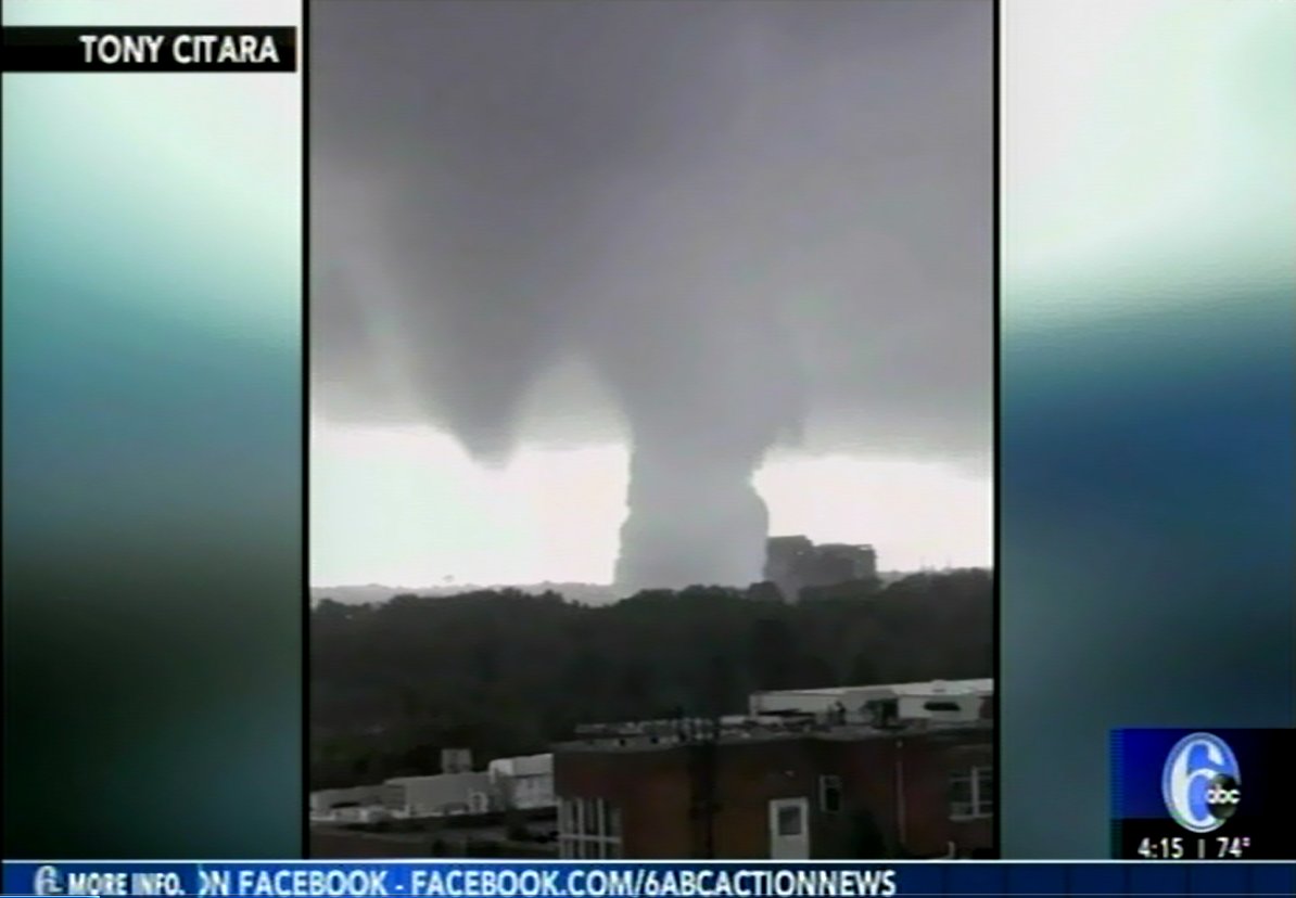
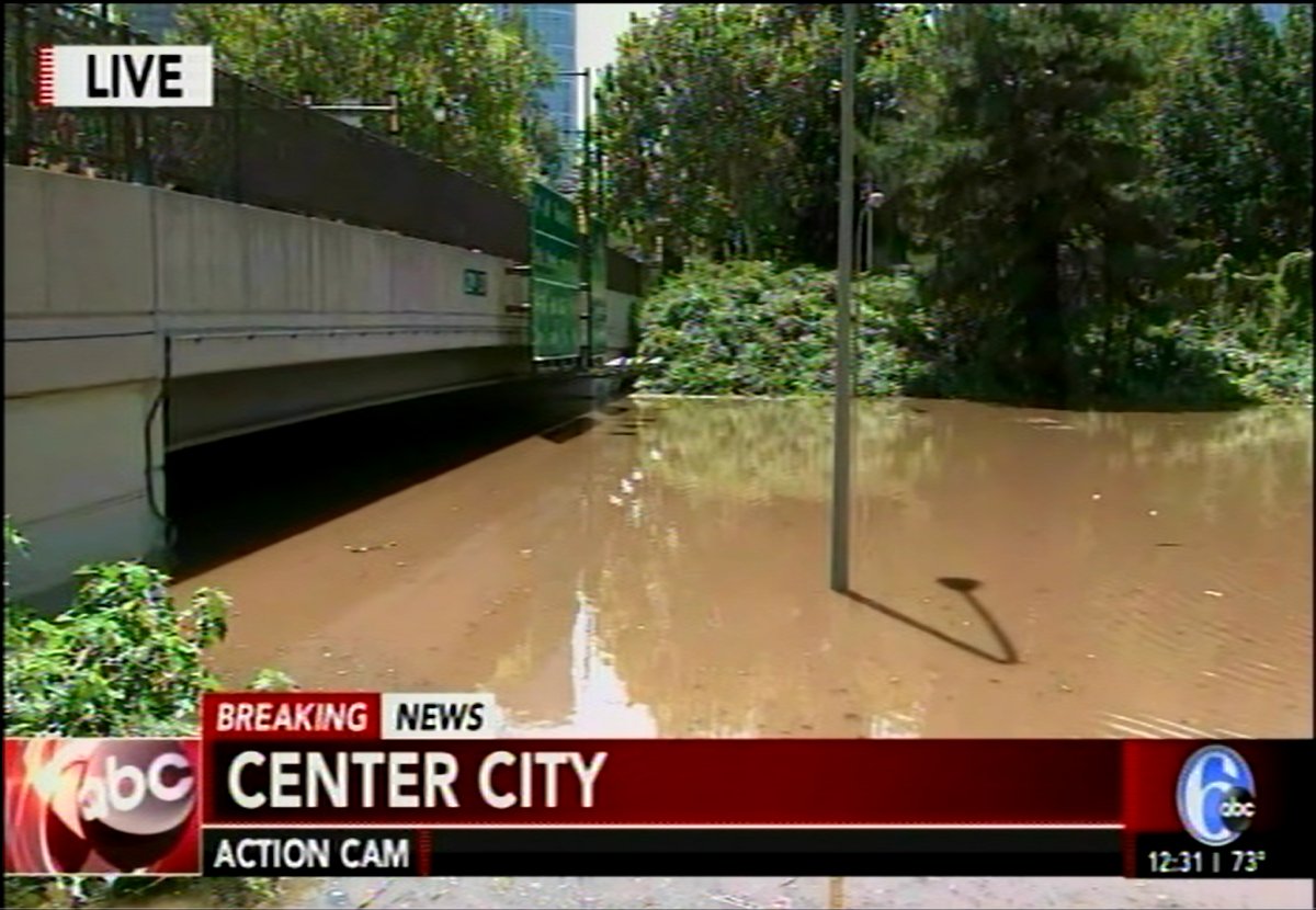
The period of the strongest storms began a little after 4PM EDT when Philadelphia’s three local news stations had begun their evening broadcasts. As the destruction unfolded all other news was forgotten and the meteorologists at those three stations continuously stayed on the air for the next four hours while the National Weather Service issued tornado warning after tornado warning, flash flood warning after flash flood warning.
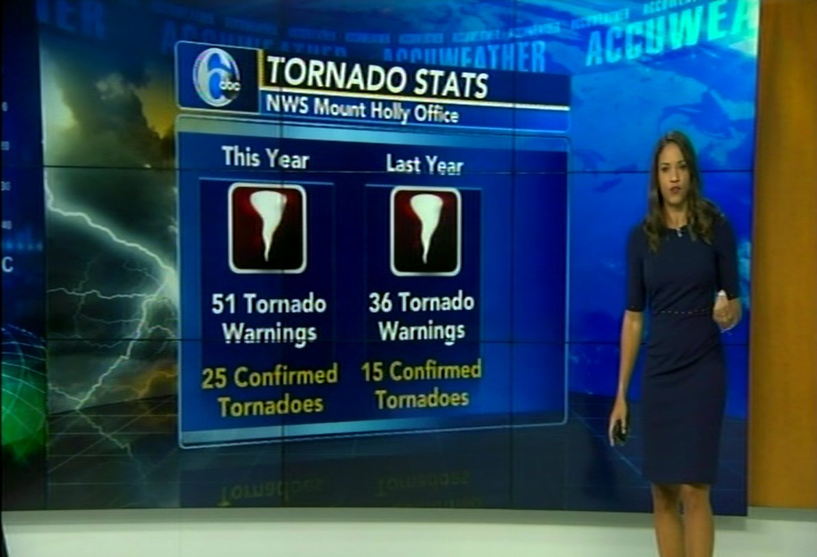
Several of the weatherpersons who have lived all their lives in the Philadelphia area were simply stunned by the enormity of the storm’s power. “Philadelphia doesn’t get weather like this” they continually stated, “This is historic”. And it was; 20 record rainfall totals were set along with record flooding in many creeks and rivers. And so far this year the Delaware valley has seen 25 tornadoes. I don’t think we had 25 tornadoes in the first sixty years of my life!
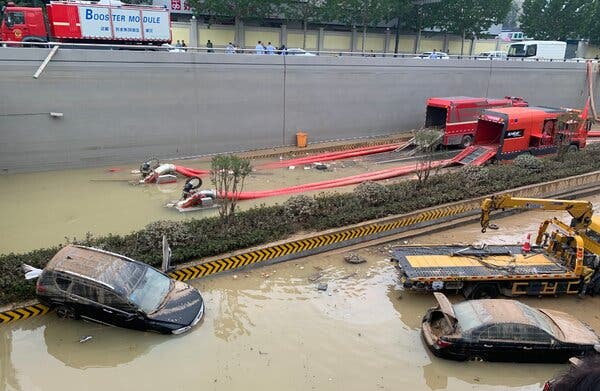
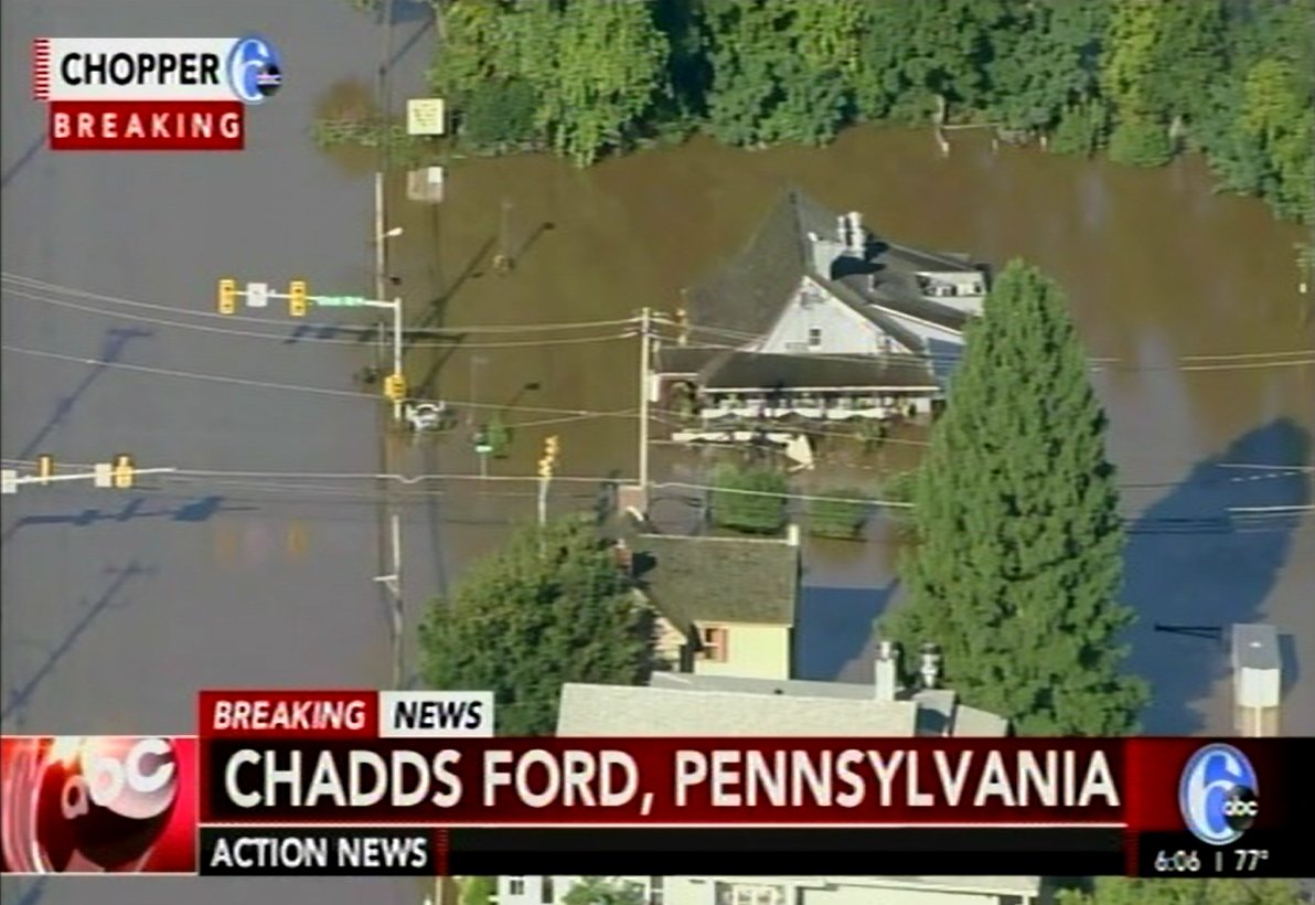
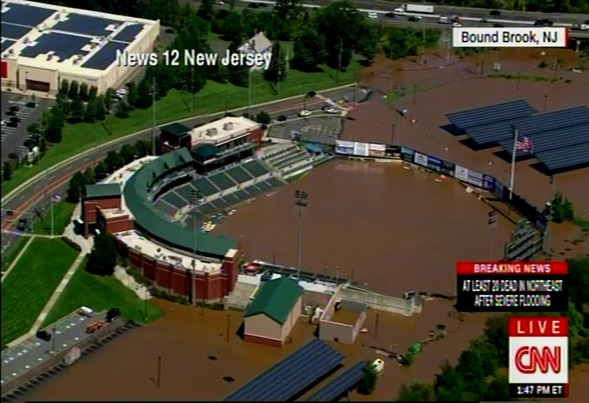
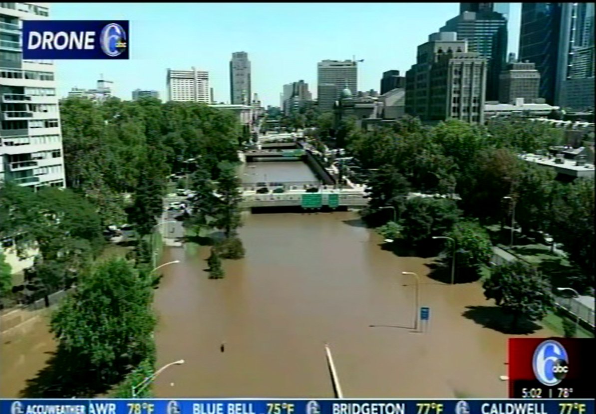
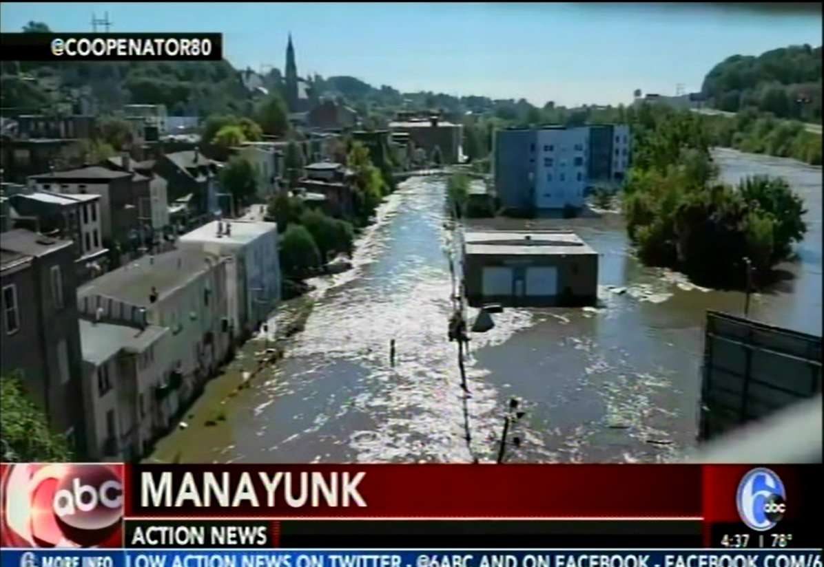
I almost feel guilty to say it but I was safe throughout the entire ordeal, my neighborhood got 10Cm of rain but fortunately nothing worse. Many people were not so lucky. As I write these words 50 people are known to have died and thousands more have lost their homes or automobiles. Indeed the number of cars that were simply abandoned by their drivers because they were stuck on crowded highways while the waters rose around them is simply unbelievable. Many areas of Philadelphia and the surrounding communities that I known very well are currently underwater and will remain so for days, and only then can the cleanup effort begin.
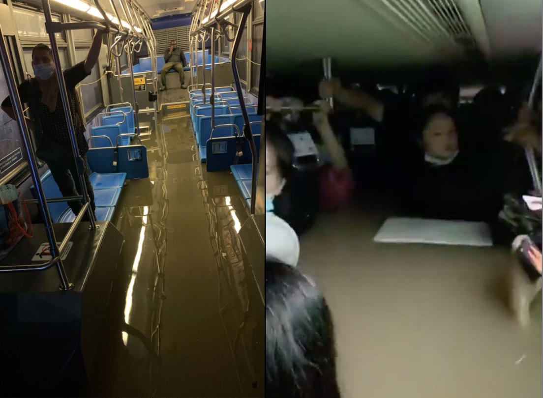
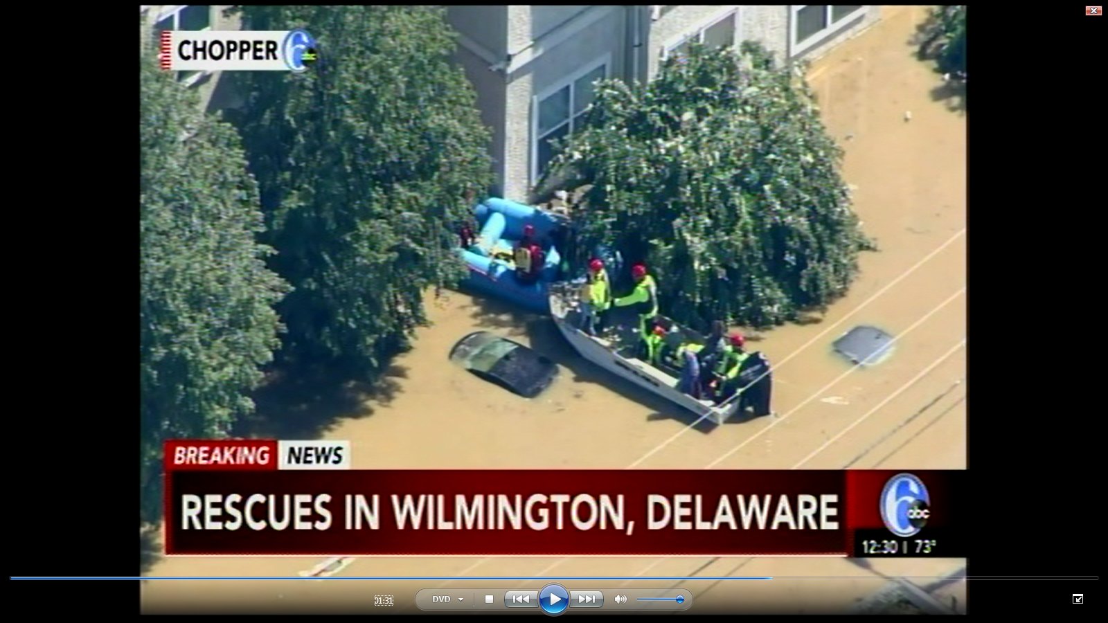
The city of New York suffered similarly with the heaviest rain ever measured falling on Central Park and many of the city’s subway stations closed due to flooding. Of course its not just the big cities that suffered, smaller cities like Wilmington, Delaware and Trenton, New Jersey also saw major flooding along with scores of smaller towns. In all three states there were hundreds of water rescues of people whom the waters had trapped in their cars or homes.
With such extreme weather of course climate change was bought up and I suppose it’s a sign of some progress that all of the weathercasters and most of the newspersons I watched that night have accepted global warming as a major factor in the strength of these storms. After all global warming is heating our atmosphere and oceans, and since heat is just a form of energy that warming just makes the storms that develop over the oceans much more energetic, that much more deadly. It’s that extra energy that is turning once in a hundred, once in five hundred year weather events into the new normal.
However it still seems that there are plenty of politicians who will do anything and everything in their power to keep on burning fossil fuels. The battle isn’t won yet; let’s be honest, it’s only just started.
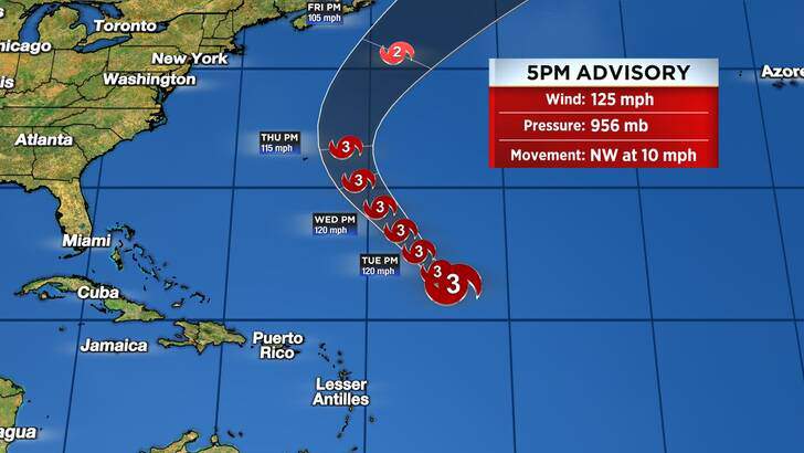
Oh, and Hurricane Larry has formed out in the Atlantic, its expected to grow into a big one!