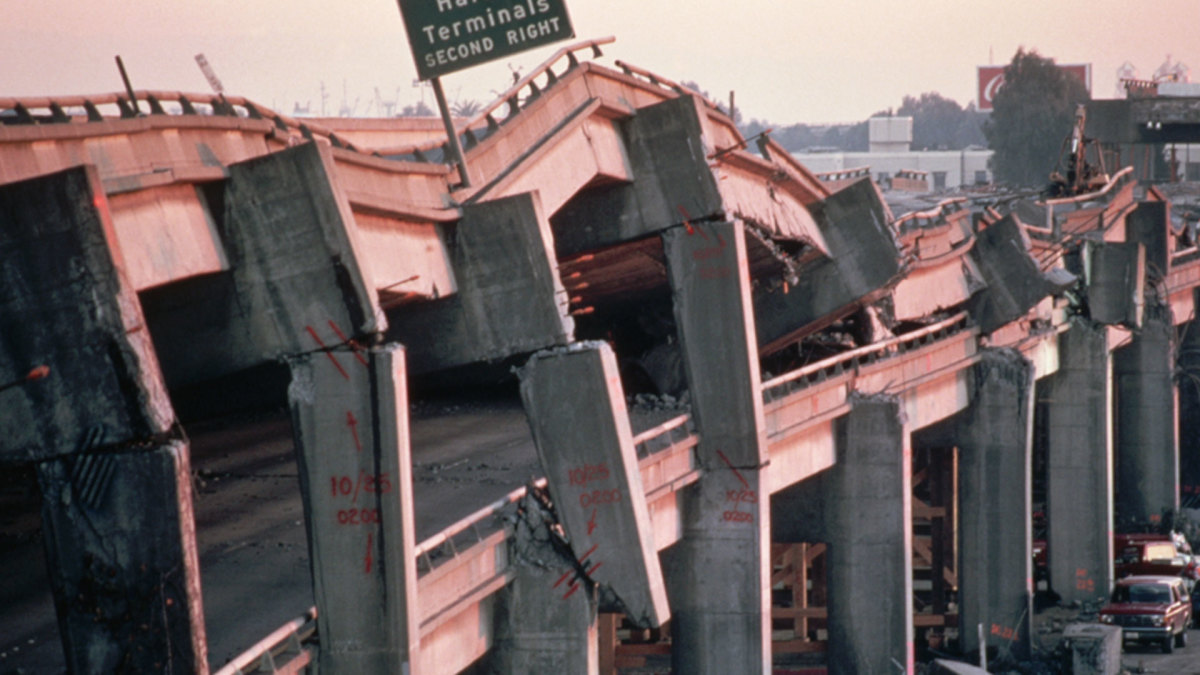
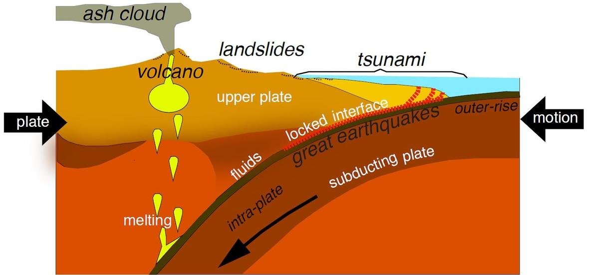
Even if you haven’t experienced one yourself we all know about Earthquakes. Those destructive and often deadly events where the ground shakes and rumbles because two sections of the Earth’s crust are either moving past each other or one is literally shoving itself against the other. These shoving matches come about because the Earth’s crust is divided into a series of what are called tectonic plates that ‘float’ upon the planet’s hotter, soften mantel.
While the hard crust is only around 20 kilometers thick on average the Mantel beneath it is much thicker, approximately 3000 kilometers thick. And beneath the mantel lies Earth’s liquid core. This means that, as you go deeper beneath the planet’s surface the rocks become ever hotter and softer until they actually become molten.

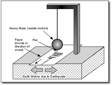
If you think about it then, Earthquakes must really be a phenomenon of the rocks near the surface, where they are harder and tend to break suddenly and catastrophically. Deeper rocks on the other hand, at hotter temperatures and higher pressures would bend or deform slowly rather than break abruptly. And in fact the greater majority of Earthquakes that geologists have studied since the invention of the seismograph have occurred less than 100 kilometers beneath the surface.

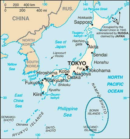
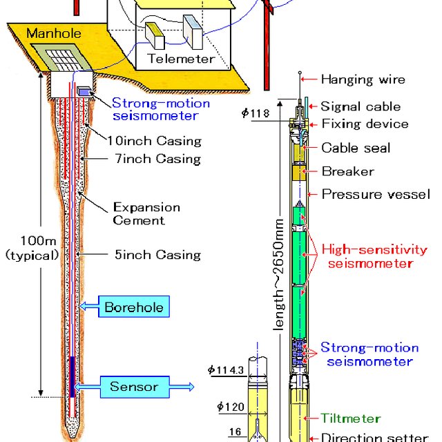
In June however an Earthquake was detected near Japan’s Bonin Islands in an area known geologically as the Izu-Bonin-Mariana arc. In this location the vast Pacific Plate is diving beneath the Philippine Sea Plate leading to many small and even some large quakes such as a 7.9 magnitude quake that rattled the Bonin Islands back in 2015. The quake that was detected in June of 2020 is considered to be an aftershock of the 2015 quake and was so weak that it could not even be felt at the surface. What stunned the researchers at the University of Arizona who analyzed the data from Japan’s Hi-net array of seismic sensors however was the depth of the quake’s epicenter, fully 750 kilometers below the surface.
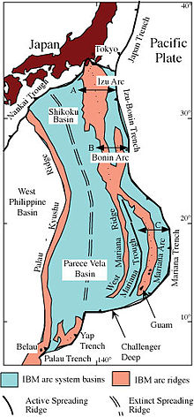
For a quake to be generated so far down in the lower mantel is quite impossible according to many theories of Earth’s inner structure. What the June quake may therefore be telling us is that the precise depths at which the various layers of the mantel occur may not be exactly where we think they are. It has already been suggested that the mantel beneath the Izu-Bonin-Mariana arc may be different than it is in most areas of the world because it is a subduction zone where the Pacific plate’s crust material is being pushed down under the Philippine Sea plate. That could mean that harder, more brittle rocks are being thrust deeper than we thought they could enabling a rare quake even as far down as 750 km.
In any case the 750 km deep Earthquake is a mystery that seismologists will have to study and understand. Hopefully as new, more sensitive sensors like Japan’s Hi-net array become available other deep quakes will be detected giving additional clues as to their nature and allow geologists to better understand the inner workings of our home planet.
Even as geologists study the Earth today in the hope of learning its secrets they are also trying to discover as much as they can about its past. One thing we do know about our planet is that it is a dynamic place, that its face may change slowly but it changes relentlessly. How much that face has changed is the subject of a study undertaken by the Geoscience Department of the University of Queensland Australia.
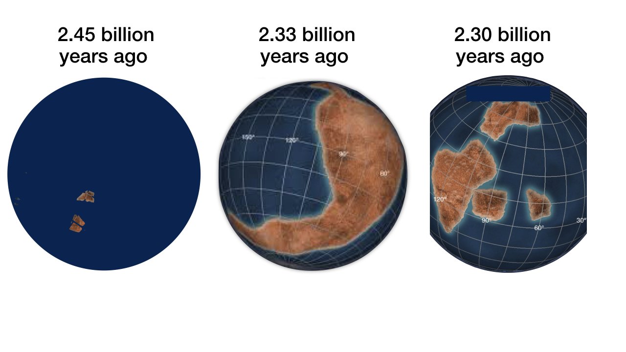
We were all taught in grade school that the surface of the Earth is mostly water; only about 30% is dry land making up the seven continents we all know. However there is considerable geological evidence that in the distant past oceans once covered our planet’s entire surface, that there were no continents, just one big ocean. Currently the consensus opinion is that the first continents appeared above sea level about 2.5 billion years ago and that tectonic activity to move the continents began at about the same time.
The new study, which was published in the journal Proceedings of the National Academy of Sciences examined sandstone deposits from what are considered to be the oldest fragments of land in the world, areas known as cratons in India, Australia and South Africa. Now sand is formed when the rocks in mountains and hills erode due to the action of rain and wind, so you can’t get sandstone until after land exists. Therefore, if you can measure the age of the oldest sandstone then you have a minimum age for the existence of continents.

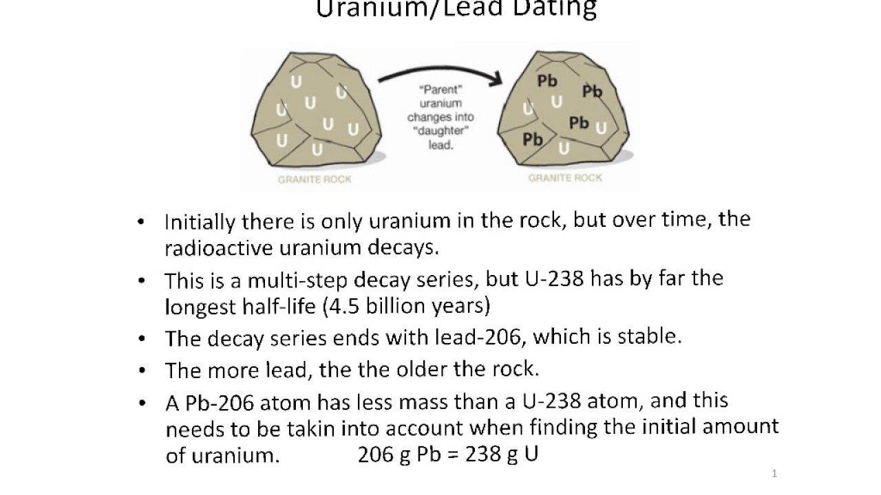
Starting in the Singhbhum craton in the eastern part of the Indian sub-continent the geologists found several formations of ancient sandstone. Within the sandstone they succeeded in extracting grains of the mineral zircon which contains small amounts of the radioactive element uranium. The uranium in the zircons can accurately dated by a technique known as Uranium – Lead dating, the very technique by which the age of the Earth was first measured.

The measurements obtained showed that the sandstone in India was about 3 billion years old, 500 million years older than what was thought to be the oldest age for land deposits.
Later dating measurements from Australia and South Africa came up with approximately the same age so it appears that before 3 billion years ago several land masses, several continents had poked themselves above the oceans waves. What processes enabled those first continents to form are yet another mystery of the Earth. But knowing exactly when that process took place will help geologists to eliminate some incorrect theories. That’s how science works, by comparing measurements to theories and the more, and more accurate the data the more accurate we can make our theories.