
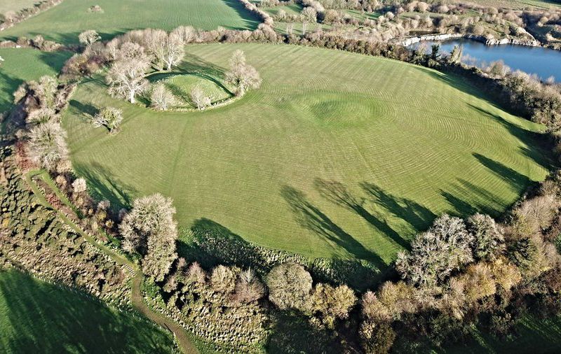
According to ancient Irish history and myth the high kings of Ulster, who ruled from about 1000BCE to 500CE, resided at a place known as Emain Macha. Today that site is called Navan Fort and is located just outside of the town of Armagh in Northern Ireland.
Just how much of those ancient records are history, and how much are myth is often difficult to tell, that’s why the discoveries made by archaeology are so important in helping us to separate fact from fiction. Now a new study of Navan Fort is giving preliminary indications that there are more structures hidden in the soil than previous studies had found, that we’ve literally only just scratched the surface of the archaeological remains at Emain Macha.
The study was conducted by Queen’s University in Belfast but because the site is a well known historical and tourist attraction none of the usual digging associated with archaeology was conducted. Instead the researchers, led by study authors James O’Driscoll, Patrick Gleeson and Gordon Noble surveyed the site using high tech, non-invasive tools such as those I described in my post of 27 June 2020.
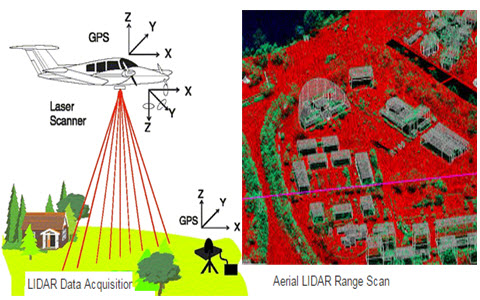
The scientists began their work with an aerial mapping of the site conducted by a technique known as LiDAR. The LiDAR instrument uses laser beams similar to those in a bar code scanner to sweep the ground from an airplane in order to construct a point-by-point 3D contour model of the entire site. LiDAR scans are so precise and accurate that small bumps and gullys that are imperceptible on the ground become clearly visible in a LiDAR generated plot. See image below.
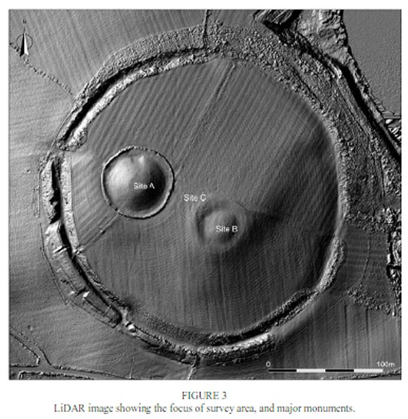
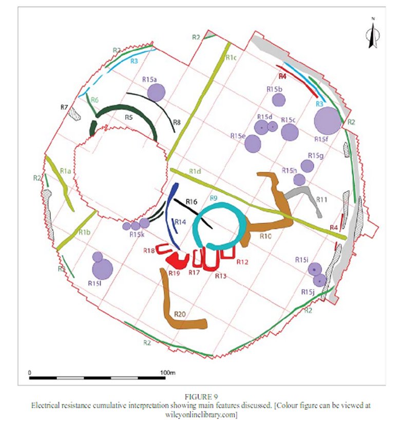
Having obtained a LiDAR survey of the entire site the researchers followed up their high altitude study with ground level Magnetic Gradiometry and soil Electric Resistance measurements. See images below.
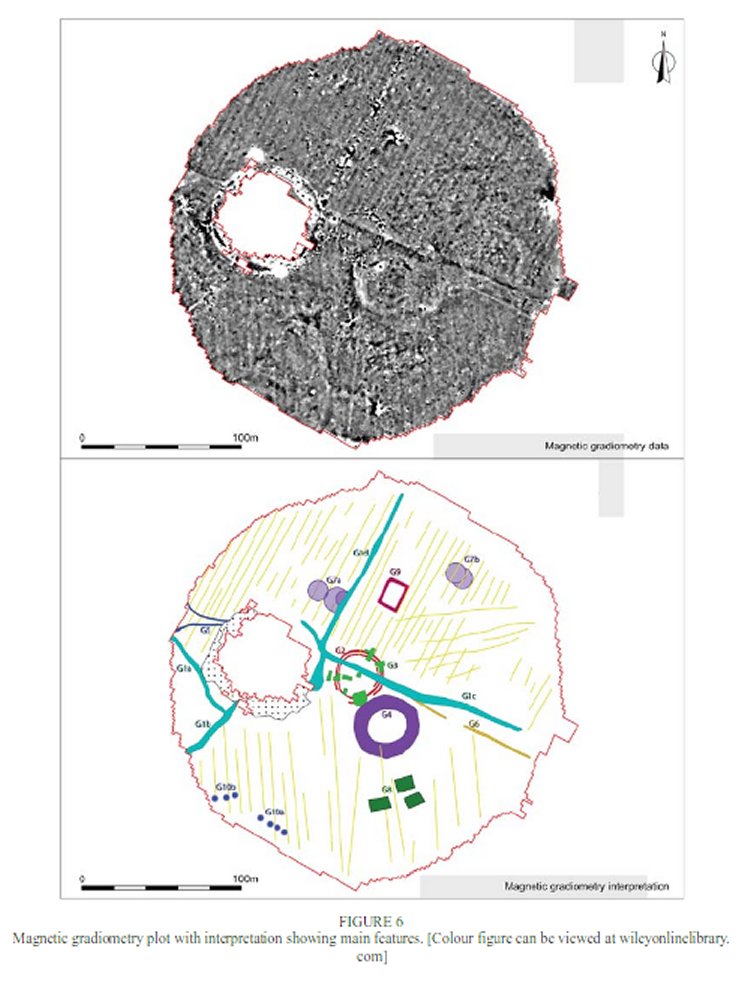
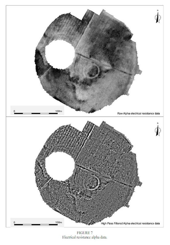
When assembled into one map of the entire site the multiple readings reveal a large number of hidden, subsurface structures within the main outer ring of the fort. See image below.
Of particular interest to the archaeologists was a number of what appears to be two circular structures overlapping each other and forming a figure eight shape. While round houses are typical throughout the ancient Celtic world the purpose of these overlapping figure eights is currently unknown. That’s the problem with the high tech, non-invasive techniques, while they may shown the location and general shape of what’s hidden under the ground they can’t reveal exactly what those structures are nor precisely when they were built and occupied. To answer those questions it is necessary to do some actual digging.
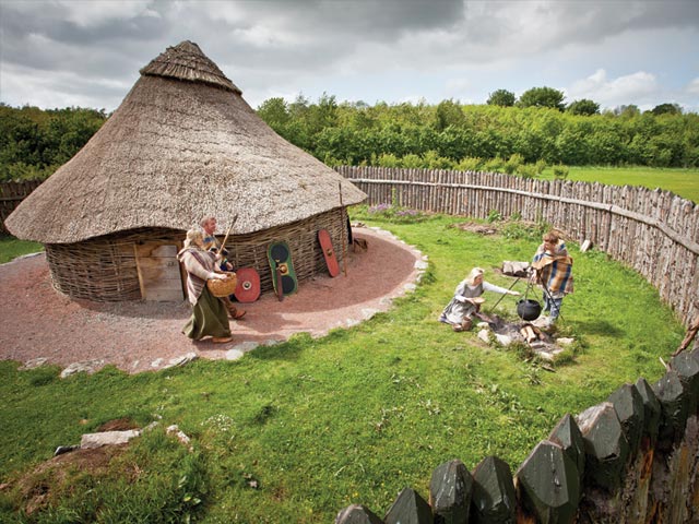
This is not the first time that Navan fort has been surveyed by archaeologists, excavations carried out during 1960s and 1990s discovered the largest known building dating from prehistoric Ireland, a 40m diameter roundhouse. Like Stonehenge in England however Navan fort is important both historically and culturally so any actual digging that takes place there must be carried out sparingly and carefully.

It was in the hopes of acquiring the funding for actual excavations that the archaeologists at Queen’s University conducted their high tech examination. By first using non-destructive instruments to locate hidden structures the scientists can concentrate on the most interesting areas, hoping to not only get the most bang for their buck but the most discoveries for each shovel full of dirt.
The stories associated with Navan Fort are rooted deep in Irish culture. Most famously the location plays a prominent part in the Ulster Cycle of stories as the home of the hero Cù Chulainn, Conchobar mac Nessa the king of Ulster and Deirdre the most beautiful woman in Ireland.

Whether of not archaeology can ever provide evidence that those legendary characters ever lived is questionable, but it is the only way we have of learning something about how it was that the people of those times lived.