Geology News for September 2023: Evidence of Plate Tectonics early in Earth’s history and will our planet have another Super-Continent some time in the future.

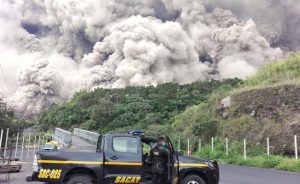
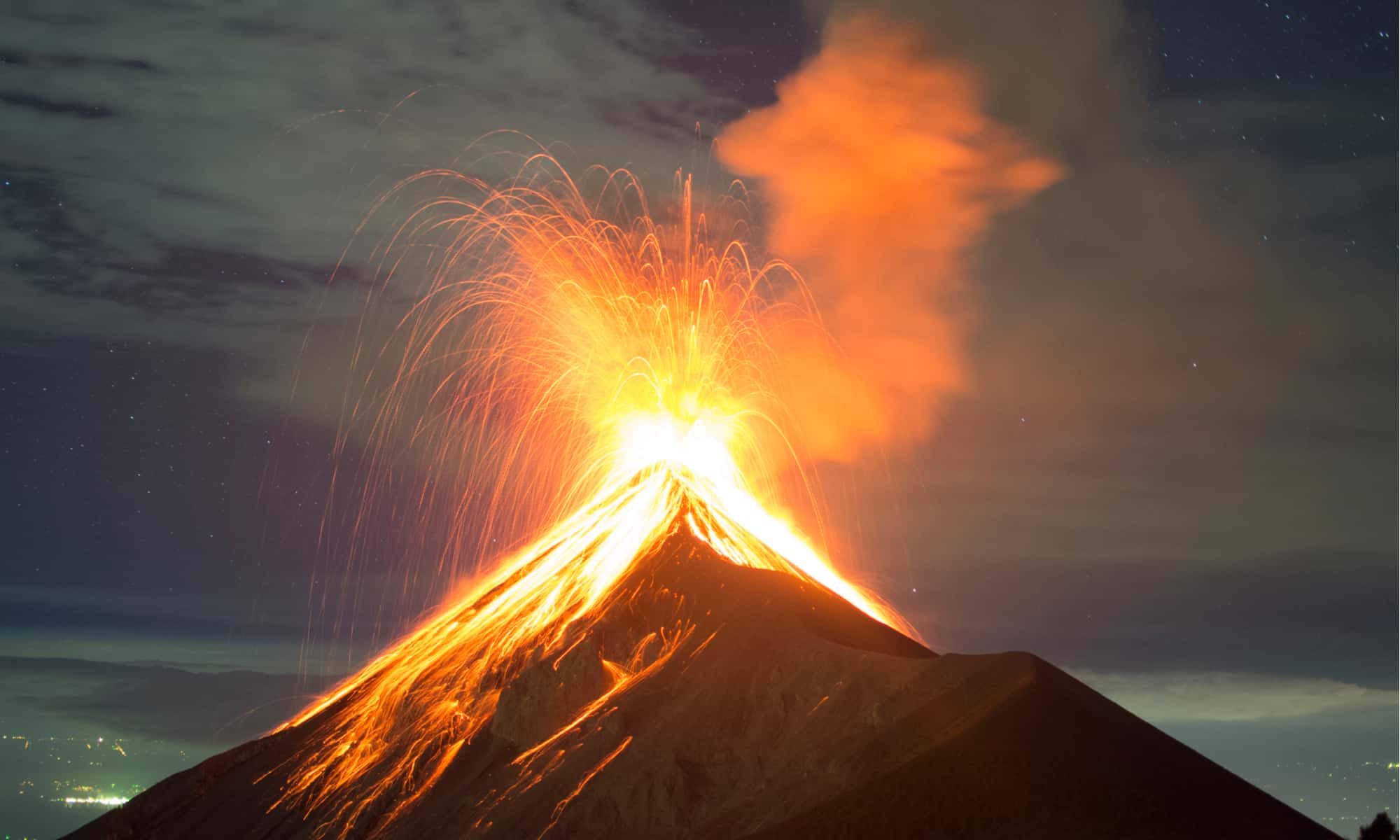
It may not seem like it to such short lived creatures as we humans but the Earth is really a very dynamic place. Yes, it’s true that we do notice the occasional outburst like an earthquake or volcanic eruption but we are hardly aware of the constant and steady but slow, emphasis on slow, movements of the ground beneath our feet. That movement is called Plate Tectonics and as an example the entire North American continent is moving westward at a rate of about five centimeters per year. Now that may not sound like a lot but for an entire continent, and remember the Earth has a lot of time for little movements to add up to big changes.

An erupting Volcano is the most obvious evidence of a dynamic planet, but the ground beneath your feet is constantly moving with the tectonic plates that carry entire continents. (Credit: AZ Animals)

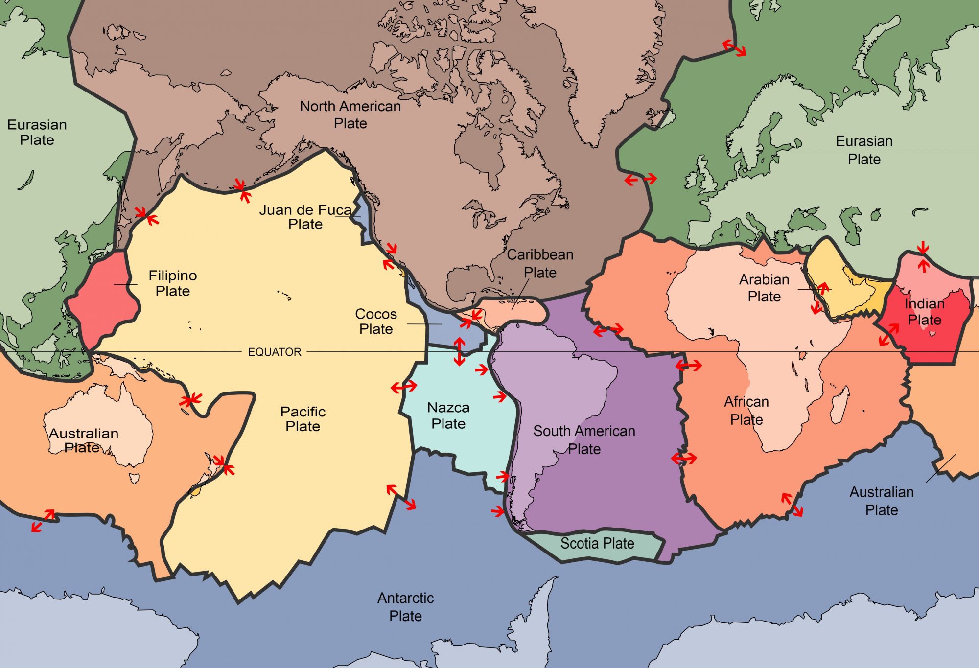
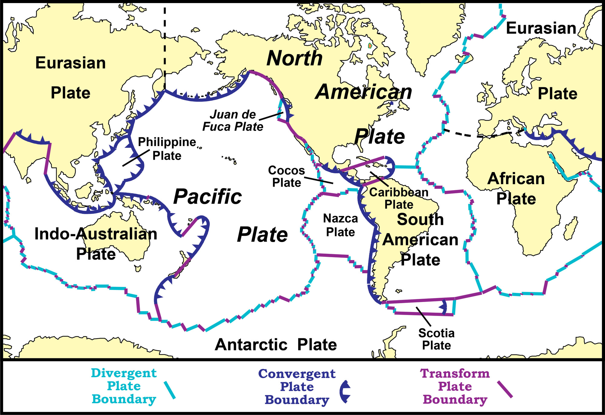
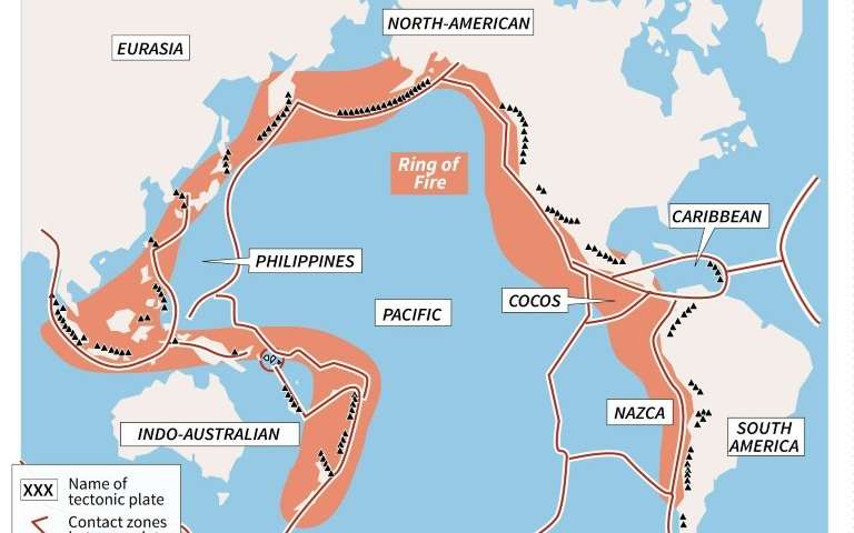
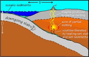
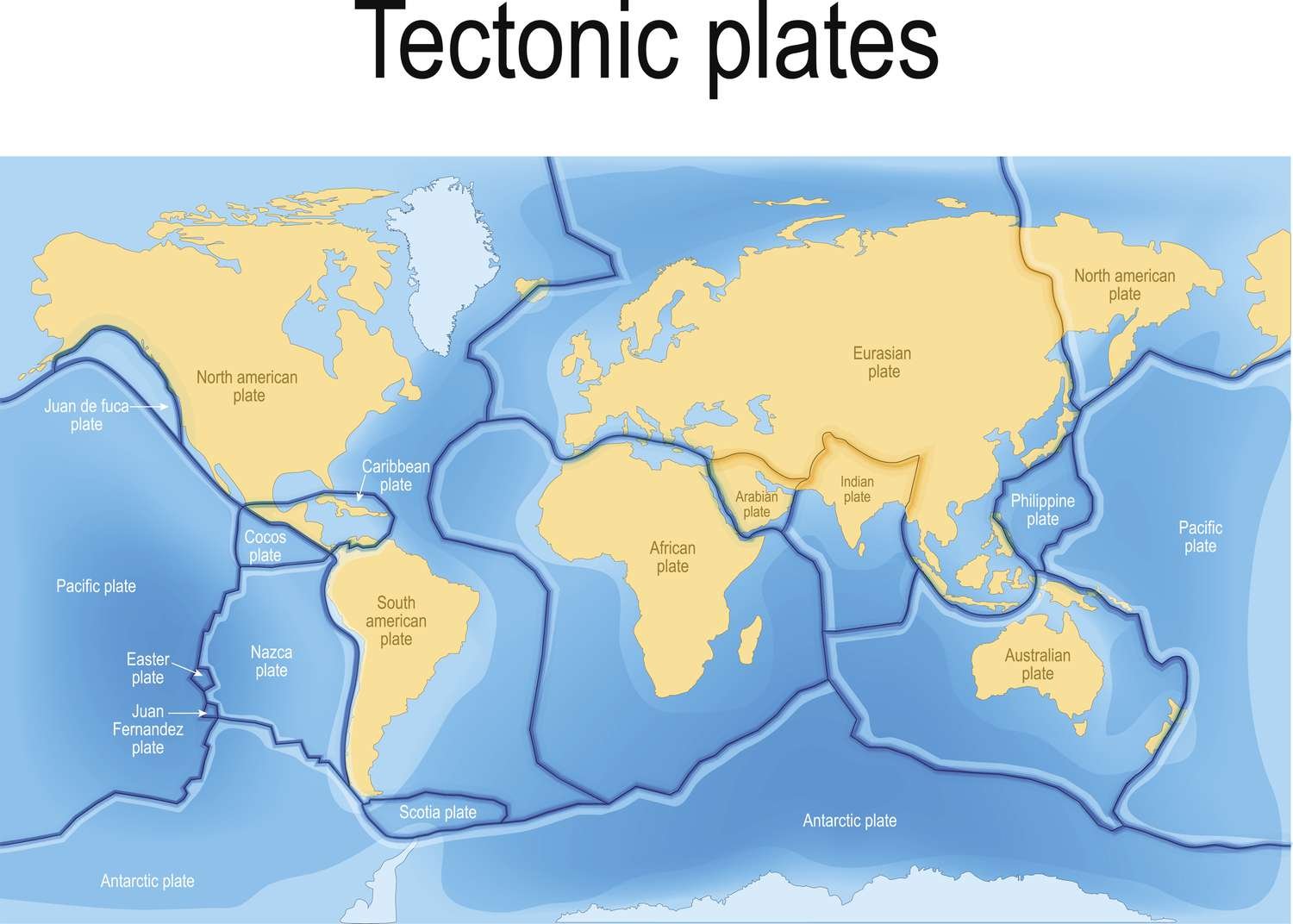
Today the surface of the globe consists of about fifteen different sections or plates, some big, some smaller, that push and squeeze against each other. Sometimes the plates grow, as when seafloor spreading is forcing North American and Europe apart. Sometimes they shrink as when subduction around the edge of the Pacific eats away at the largest plate.

The surface of the Earth is broken up into a number of tectonic plates that push and jostle against each other. That interaction is the cause of most earthquakes and volcanoes. (Credit: ThoughtCo)

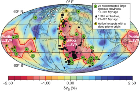
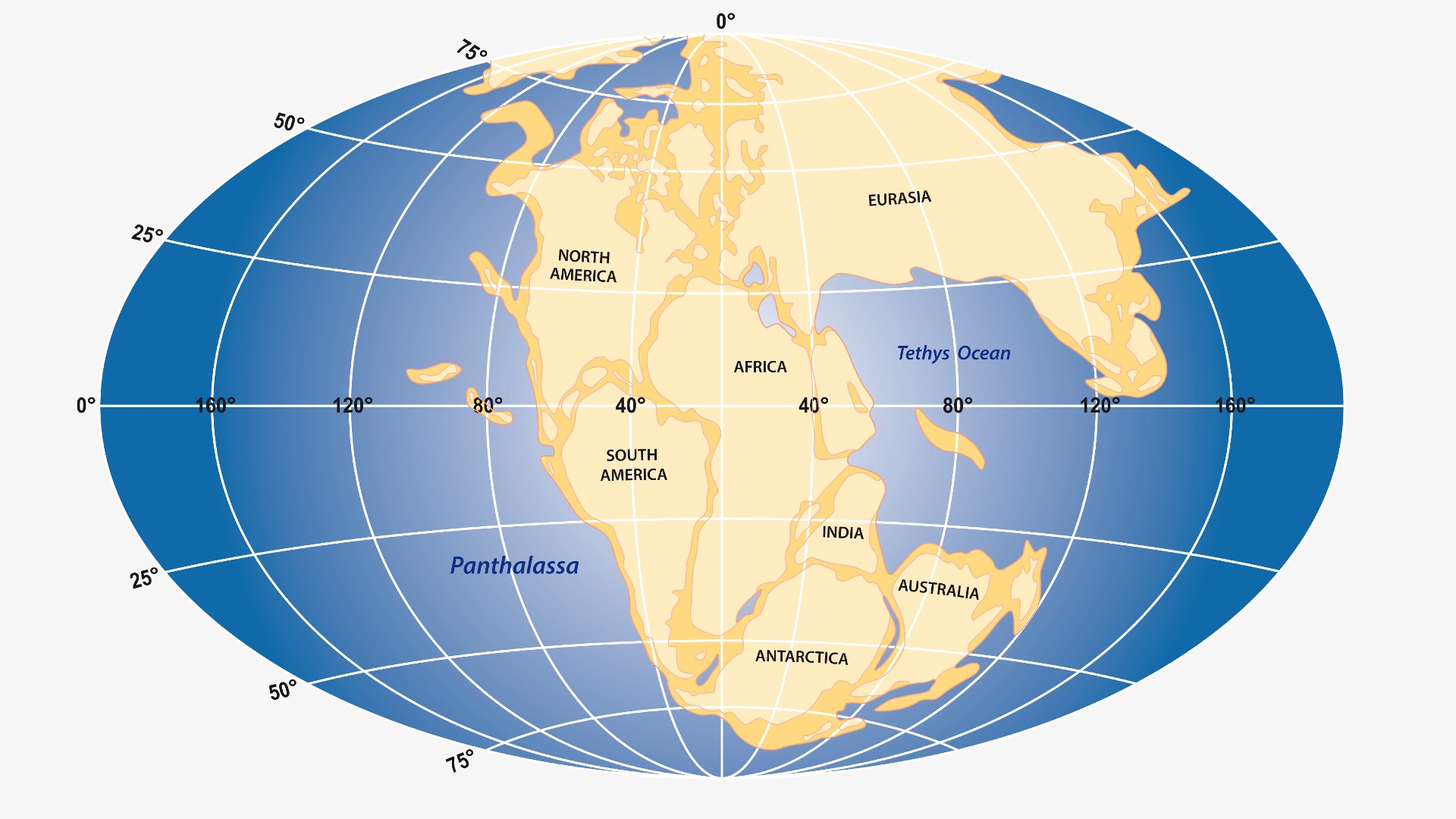
Geologists studying plate tectonics of course ask themselves just when in Earth’s history did the process of plate tectonics begin. They know for example that about 250 million years plate tectonics caused all of the land masses to come together to form one giant super-continent that’s been named ‘Pangaea’. However four and a half billion years ago the Earth’s surface was still molten so there certainly weren’t any tectonic plates back then.

As our planet was forming it was under constant bombardment by asteroids and other pieces of space rock. The heat of that energy kept Earth’s surface molten for millions of years. (Credit: Smithsonian Magazine)

Did plate tectonics begin as soon as Earth had a solid surface? Or were there other processes at work on the early Earth before plate tectonics started? Just when did plate tectonics begin to reshape Earth’s surface?

So did the tectonic plates form as the Earth’s surface cooled and became solid or did they form sometime later? (Credit: Universe Today)

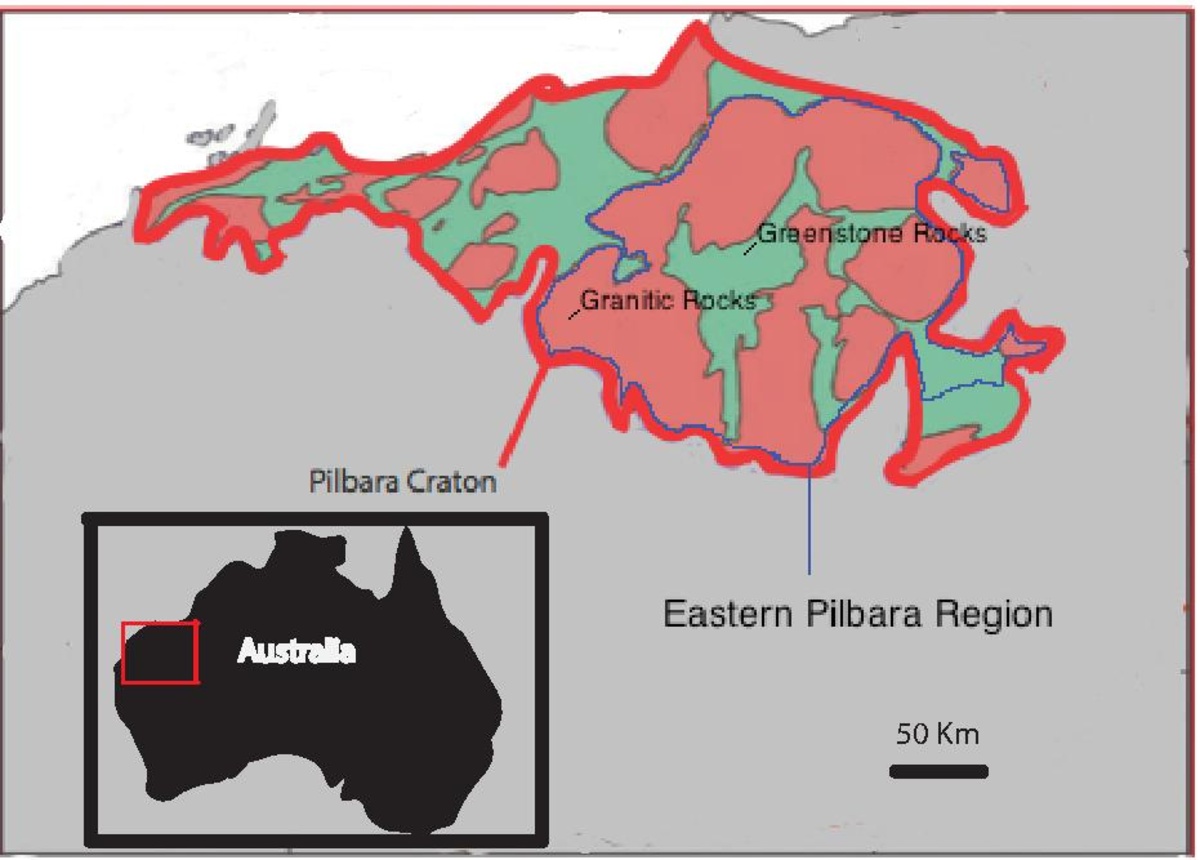
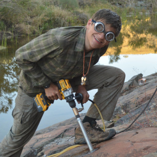
Recent evidence has been found in the Pilbara Craton region of western Australia which sheds light on that question. The rocks of the Craton are among the oldest on Earth’s surface, some are dated back to about 3.2 billion years ago. Using instruments and techniques of their own invention a team of geologists from Harvard University in the US led by Alec Brenner and Roger Fu showed that 3.2 billion years ago the entire Pilbara Craton region was moving at a speed of 6.1 centimeters per year, a rate very similar to that which our modern tectonic plates are moving.

The Pilbara Craton region of western Australia contains some of the oldest rocks on the surface of the Earth. (Credit: Wikipedia)
Just by looking at some of the rocks of the Pilbara Craton even an amateur can tell that they are old, that a lot of geology has happened here! (Credit: Reddit)

Doctors Brenner and Fu also found evidence for another of our planet’s dynamic processes, the flipping of Earth’s magnetic poles, north becoming south and south, north, see my posts of 8 February 2017 and 16 January 2017. While there is still a great deal that we don’t understand about how the magnetic poles flip, or why our planet even has magnetic poles for that matter, there is overwhelming evidence that they have flipped 183 times in the last 83 million years. Now the evidence that Brenner and Fu have uncovered shows that the poles have been switching for at least over three billion years.

Geological evidence tells us that our planet’s magnetic poles have ‘flipped’ many times, north becoming south and vice versa. (Credit: NASA Climate Change)

Speaking of their discoveries Doctor Brenner remarked. “It paints this picture of an early Earth that was already really geodynamically mature. It had a lot of the same sorts of dynamic processes that result in an Earth that has essentially more stable environmental and surface conditions, making it more feasible for life to evolve and develop.”

Geologist Alec Brenner having fun. That’s the best part of being a scientists, we actually love our work! (Credit: Research Gate)

So plate tectonics has been causing Earth’s land masses to push and collide and bounce off of each other for over 3 billion years now. And as I mentioned above 250 million years ago all of the planet’s land masses were jammed together in a single super-continent. What about the future? Is another super-continent going to happen some day?

About 250 million years ago the movement of the tectonic plates brought all of Earth’s continents together into a single supercontinent called Pangea. Will that happen again? (Credit: Live Science)

Yes, according to a new study conducted by researchers led by Australia’s Curtin University. In fact according to the model super-continents occur on Earth about every 600 million years so the next one should form about 280 million years from now around the North Pole.

The future supercontinent ‘Amasia’ predicted by the geophysicists at Curtin University. We only have about 280 million years to wait! (Credit: Science)

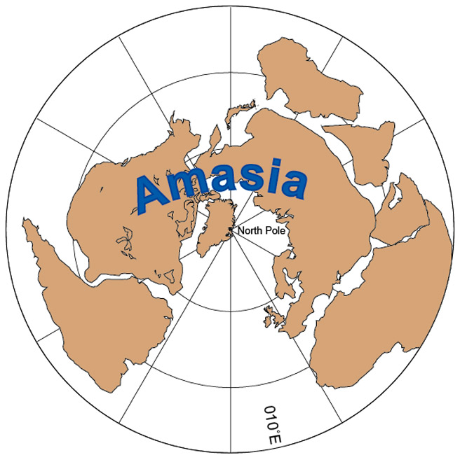
The researchers have already given the coming super-continent a name ‘Amasia’ because, according to led author Dr. Chuan Huang, it will form when North America and Asia collide causing the Pacific Ocean to vanish. Of course that’s not going to happen for a long time. A long time that is to such short lived mayflies as we humans.

Geologists are making new discoveries that reveal the inner structure and workings of our planet Earth.     

Back about fifty years ago now the science of Geology underwent a revolution in thought as overwhelming evidence supporting the theory of ‘Plate Tectonics’ was uncovered. The basic idea of plate tectonics is that the surface of the globe is broken into a number of plates that the continents sit upon. Those plates move, extremely slowly, only centimeters per year but they do move and as they move they jostle and crash against one another causing earthquakes to occur, mountains ranges and volcanoes to be born.

The major Tectonic Plates of the Earth. Where these plates meet are the geologically active regions of the world with earthquakes, volcanoes and mountain building. (Credit: Wikipedia)

Sometimes one plate is forced under another, and when that happens a ‘subduction zone’ is created and one of the geologic features that can occur in such a zone is a deep-water trench such as the Marianas Trench, the deepest place in all of the oceans. The Marianas Trench is in fact only one of about a dozen trenches that are a part of the famous ‘Ring of Fire’ surrounding the Pacific Ocean. The precise mechanics of how these subduction zones are generated is very complicated, several attempts have been made to develop numerical models for analyzing them with computers.

Deeper than Mount Everest is high the Marianas Trench in only one of a dozen trenches that ring the Pacific Plate. (Credit: Youngzine)
The three ways that Tectonic Plates can interface. Subduction zones occur at convergent plate boundaries. (Credit: Science Sparks)

Now a new such model developed at the Instituto Dom Luiz at the University of Lisbon in Portugal has shown great promise in providing a more comprehensive and accurate picture of subduction zone evolution. This new simulation is different from previous models in that it is a full scale three-dimensional reproduction of what is going on at a subduction zone. In the program all of the dynamic forces that effect the generation and evolution of subduction zones were realistically incorporated, including gravity.

While Plate Tectonics gives us a general idea of what is going on at a Subduction Zone we need a much more detailed analysis if we hope to predict such events as earthquakes and volcanoes. (Credit: Volcano Discovery)

Such large scale simulations can require a lot of computer time; in fact each analysis using this new model takes as much as a full week to process using the supercomputer at Johannes Gutenberg University in Germany. Still the results are well worth the effort. According to Jaime Almeida, first author on the study. “Subduction zones are one of the main features of our planet and the main driver of plate tectonics and the global dynamics of the planet.”

Modern Supercomputers are performing calculations so large that they can even model events with millions of variables with constantly changing parameters. (Credit: The Atlantic)

Plate Tectonics has taught us much about the broad outline of how the surface of our Earth has changed over billions of years. However a more precise and accurate model of the processes involved may help us better understand, and therefore predict the disasters like earthquakes and volcanoes that are a common threat around the world.

Millions of people live next door to volcanoes and unexpected eruptions are major disasters. The ability to better predict such eruptions is a major goal of geology. (Credit: The Atlantic)

Now I’d like to take a moment to update a geology story that I posted about back on the 24th of June 2020 and 10th of April 2021. The story concerned the discovery of two huge, massive blobs that exist deep within the Earth’s mantel. These blobs are formally known as Large Low-Shear Velocity Provinces (LLSVPs) and differ in composition and viscosity from the surrounding material deep within the Earth. (Previously these blobs were known as Ultra Low Velocity Zones or ULVZs). The LLSVPs were detected because; being made of different materials the vibrations caused by earthquakes travel through them at a lower velocity, hence Low-Shear Velocity. They were discovered by analyzing the data from hundreds of earthquakes as measured by seismographs from around the world.

There are two big blobs of material buried deep beneath the surface of the Earth. Known as Large Low Shear Velocity Zones they are one of the big mysteries in the science of Geology. (Credit: ScienceDirect.com)

The two LLSVPs are situated one beneath South Africa and the other beneath the Pacific Ocean and are each the size of a continent with a thickness of greater than 500 km. Also, it has been speculated that the blobs may in fact be the remnants of an ancient planet called Theia that collided with the Earth four and a half billion years ago fragments of which then became our Moon.

About four and a half billion years ago a planet the size of Mars collided with the early Earth. Named Theia some of that planet’s material went on to become our moon. The possibility that the LLSVZs may be fragments of Theia has been suggested, and would be really cool! (Credit: Wikipedia)

Now a new analysis of the LLSVPs by Qian Yuan and Mingming Li of Arizona State University’s School of Earth and Space Exploration has been published in the journal Nature Science. In the article the researchers assert that the LLSVP under Africa is almost 1000 km further from the center of the Earth, and therefore closer to the surface than the one under the Pacific. In an attempt to explain this difference in height the researchers hypothesize that the Africa LLSVP could be less dense and therefore it may be ever so slowly rising through the Earth’s mantel. “The Africa LLSVP may have been rising in recent geological time,” states author Li. “This may explain the elevating surface topography and intense volcanism in eastern Africa.”

Geologists probe the interior of our planet by studying the vibration caused by earthquakes. Primary (P) waves can pass through the liquid core at Earth’s center while the Secondary (S) cannot. The LLSVZs were discovered by a careful analysis of those P and S waves. (Credit:

It is harder to study what goes on just a few hundred kilometers beneath our feet than it is to study the surface of the Moon or Mars, certainly we’ve sent more probes to the Moon or Mars than we have to a hundred kilometers down. Nevertheless bit by bit geologists are learning the secrets of the planet we all call home.

We’ve sent a space probes to photograph the surface of every planet and the Voyagers are now exploring interstellar space, but we still know so little about what our own planet is like just beneath our feet.

When I was growing up I occasionally heard a remark that scientists knew more about the surface of the Moon or Mars than they did about the inside of our own planet. Back then all we really knew about the deep interior of our Earth was that the pressure just keep getting greater as you went down simply because of the weight of all of the rock above you. At the same time the temperature got hotter and hotter because of all of the heat generated by the radioactive elements down there.

Back around 1960 this was literally about all we knew about the interior of the Earth. (Credit: ProProfs)

By studying the seismic waves generated through earthquakes scientists knew that deep within the Earth, about 5500 kilometers down, there was a liquid core because certain kinds of waves, called shear waves, will not go through a liquid. We also knew that above the core there was a quasi-plastic region called the mantel composed of rock under enormous pressure. Finally on top, where we lived there was the crust only about ten kilometers thick, made of the kind of rock that we’re all familiar with.

Geologists study the waves generated by Earthquakes to learn about the Earth’s interior. The S waves (Shear Waves) will not go through the core because it is liquid however the P waves (Pressure Waves) will. (Credit: Views of the Solar System)

Then, during the late 1960s and 70s the science of geology underwent a revolution as the controversial theory of ‘Continental Drift’ was proven to be correct and became the basis for the modern model of ‘Plate Tectonics’. The idea that Earth’s outer, solid crust is actually broken into a number of large plates that floated on top of the planet’s quasi-plastic mantel carrying the continents with them explained so much.

First proposed by Alfred Wegener in 1912, the theory of Continental Drift was largely discounted because geologists couldn’t imagine how a continent could move. (Credit: Earth How)

According to plate tectonics, earthquake fault lines, volcanoes and even the process of mountain building were found to take place in regions where two plates were either banging into each other or spreading further apart. Nevertheless, despite its success plate tectonics still only broadly describes the processes in the top one hundred kilometers or so of the Earth.

Plate Tectonics incorporates Continental Drift by recognizing that the Earth’s crust is broken into pieces that flat upon the quasi-plastic Mantel. (Credit: National Park Service)

We had little detail about conditions and processes deep within our planet, after all the deepest well ever drilled was only 12.2 kilometers deep. How could we know anything about what’s below that? Are the Earth’s liquid core and mantel uniform, is there anything like structure down there. We just didn’t know.

Until now that is. Using the latest in machine learning software a team of geophysicists from the University of Maryland have analyzed 30 years of data collected by hundreds of seismographs to generate a detailed 3D map of the region where the Earth’s core and mantel meet. Concentrating their efforts on the Pacific Ocean basin the researchers were interested in trying to understand the regions directly below the Hawaiian and Marquesas islands, volcanic ‘hot spots’ that are not connected in any way to the motion of tectonic plates. Since the Pacific Ocean is surrounded by the volcano and earthquake prone ‘ring of fire’ the geophysicists were able to collect over 7,000 seismic events of magnitude 6.5 or greater, an enormous amount of data to work with.

Caused by the interaction of the Pacific Plate with other plates the Pacific ‘Ring of Fire’ is the most geologically active region on Earth. (Credit: Phys.org)

What they found were regions of greater density and heat than even the surrounding material, previously unknown structure directly beneath the Hawaiian and Marquesas hot spots as well as other areas of the core-mantel boundary. Because these regions are hotter and denser than nearby areas the seismic waves travel more slowly through them so the geophysicists have named them Ultra-Low Velocity Zones or (ULVZs).

Using the latest in computer learning and by studying the waves generated by thousands of Earthquakes Geologists at the University of Maryland have discovered structure deep beneath the Earth’s surface. (Credit: Sci-News.com)

At the interfaces between the ULVZs and the more normal material around them echoes of seismic waves can be produced. In the past these echoes have been difficult to distinguish from random noise but the machine learning algorithm was able to recognize them, adding a lot of detail to the nature of the ULVZs.

According to Doyeon Kim, lead author of the study. “By looking at thousands of core-mantel boundary echoes at once, instead of focusing on a few at a time, as is usually done, we have gotten a totally new perspective. This is showing us that the core-mantel boundary region has lots of structures that can produce these echoes and that was something we didn’t realize before because we only had a narrow view.”

Geologists are only beginning to understand the role that Ultra Low Velocity Zones (ULVZ) have on the movement of plates and the Earth’s volcanic ‘Hot Spots’. (Credit: www3.nd.edu)

Further refinements for the technique developed by the geologists at the University of Maryland will undoubtedly discover more structures in other sections of the core-mantel boundary while at the same time providing clearer images of those ULVZs already located. Even if the deep interior of the Earth is unreachable to us physically, scientists are still finding ways study it and learn its secrets.

Volcanic Eruptions in Hawaii and Guatemala, Why are they so Different?

One of the biggest news stories over the last month has been the continuous eruption of the Kilauea volcano on the big island in Hawaii. Now Kilauea has actually been quietly erupting for the past fifty years but recently the amount and intensity of the lava flow has increased by more than an order of magnitude.

More than twenty new fissures of the volcano have opened destroying hundreds of homes. At the same time, although no one has been reported to have died thousands of people have been forced to flee to safety. The images below show some of the power of the Kilauea volcano.

Eruption of Kilauea (Credit: UK Express)

Destruction of Kilauea (Credit: Newsweek)

Now just four days ago in the Central American nation of Guatemala the Volcan de Fuego, that’s Spanish for the Volcano of Fire, erupted sending a torrent of hot ash and mud through surrounding villages. This landslide of material is technically known as a pyroclastic flow and is the same phenomenon that buried the ancient Roman town of Pompeii.

Within minutes of the eruption in Guatemala hundreds were either dead or missing and thousands left homeless. The images below show some of the destruction cause by the Volcan de Fuego.

Volcan de Fuego (Credit: Clarin)

Pyroclastic flow from Volcan de Fuego (Credit: El Universal)

So what’s the difference here? The power of both volcanoes is inexorable; all that we humans can do is just run away until the volcano calms down as they always do. Still the lava flow from Kilauea has been steady, measured. So much so that you can almost walk to safety.

The ash flow from de Fuego however was like a tsunami, so fast that many people were engulfed before they knew what was happening, so fast that cars sometimes could not keep ahead of it.

The volcanic material from the two volcanoes even looks completely different. The lava from Kilauea is the classic molten red liquid that cools to a pitch-black hard rock. The material from Volcan de Fuego on the other hand is a gray powder that coats and chokes everything. The images below show the differences in the material coming from the two volcanoes.

Lava from Kilauea moves slowly (Credit: USA Today)

Ash Produced by Volcan de Fuego (Credit: Lavanguardian)

How can they be so different, they are both volcanoes aren’t they? Yes, they are both volcanoes but there are profound differences between them, and those differences can teach us a great deal about our planet. Kilauea is the simpler to describe and understand so I’ll start with it.

Kilauea, and all of the volcanoes that formed the Hawaiian island chain sit on a hole in the Earth’s crust that allows material from deep down to rise to the surface. Technically known as a ‘Hot Spot’ this hole reaches into the mantel, or even deeper, where the material is both hotter and more thoroughly mixed. Because of this smooth consistency volcanoes like Kilauea do not get clogged, they tend to spew out some lava all of the time.

Another thing to remember about Hot Spots is that they don’t move with the Earth’s tectonic plates. That’s how the Hawaiian island chain was formed as the Pacific plate slide across the Hot Spot forming new volcanoes, i.e. new islands as the plate shifted. So Kilauea is not caused by plate tectonics.

On the other hand Volcan de Fuego is a product of plate tectonics, it is directly generated by the movement of the North American plate over the Pacific plate. As the material of the Pacific plate is subducted beneath the North American it pushes upward spawning mountains and volcanoes. It is this mechanism that has produced the so-called ‘Ring of Fire’ around the Pacific Ocean. The image below illustrates how such a subduction zone works.

Diagram of Subduction Zone (Credit: Oregon State University)

However the material that rises up through volcanoes like Volcan de Fuego doesn’t come up as consistently as it does from a Hot Spot. This means that these volcanoes can go dormant for years or even decades. During this dormancy the volcano dome and lava chamber can harden and when pressure again starts to build the dome becomes a cap and the pressure just builds until it explodes destroying everything for kilometers in a matter of minutes. This is what happened at Vesuvius in 86CE, at Mount St. Helens in 1980 and happened at the Volcan de Fuego this week.

Kilauea and Volcan de Fuego may appear very similar above ground but by studying their differences we have learned a deeper truth about the forces that created them.