When I was growing up I occasionally heard a remark that scientists knew more about the surface of the Moon or Mars than they did about the inside of our own planet. Back then all we really knew about the deep interior of our Earth was that the pressure just keep getting greater as you went down simply because of the weight of all of the rock above you. At the same time the temperature got hotter and hotter because of all of the heat generated by the radioactive elements down there.

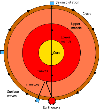
By studying the seismic waves generated through earthquakes scientists knew that deep within the Earth, about 5500 kilometers down, there was a liquid core because certain kinds of waves, called shear waves, will not go through a liquid. We also knew that above the core there was a quasi-plastic region called the mantel composed of rock under enormous pressure. Finally on top, where we lived there was the crust only about ten kilometers thick, made of the kind of rock that we’re all familiar with.
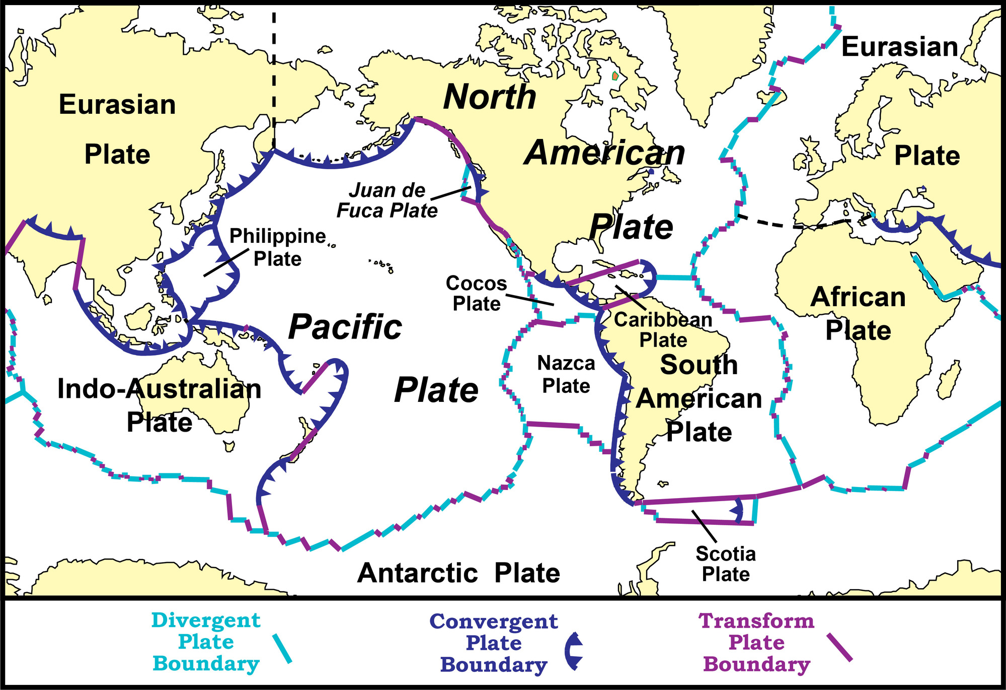
Then, during the late 1960s and 70s the science of geology underwent a revolution as the controversial theory of ‘Continental Drift’ was proven to be correct and became the basis for the modern model of ‘Plate Tectonics’. The idea that Earth’s outer, solid crust is actually broken into a number of large plates that floated on top of the planet’s quasi-plastic mantel carrying the continents with them explained so much.

According to plate tectonics, earthquake fault lines, volcanoes and even the process of mountain building were found to take place in regions where two plates were either banging into each other or spreading further apart. Nevertheless, despite its success plate tectonics still only broadly describes the processes in the top one hundred kilometers or so of the Earth.
We had little detail about conditions and processes deep within our planet, after all the deepest well ever drilled was only 12.2 kilometers deep. How could we know anything about what’s below that? Are the Earth’s liquid core and mantel uniform, is there anything like structure down there. We just didn’t know.
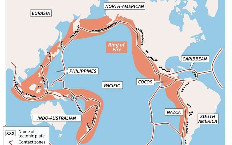
Until now that is. Using the latest in machine learning software a team of geophysicists from the University of Maryland have analyzed 30 years of data collected by hundreds of seismographs to generate a detailed 3D map of the region where the Earth’s core and mantel meet. Concentrating their efforts on the Pacific Ocean basin the researchers were interested in trying to understand the regions directly below the Hawaiian and Marquesas islands, volcanic ‘hot spots’ that are not connected in any way to the motion of tectonic plates. Since the Pacific Ocean is surrounded by the volcano and earthquake prone ‘ring of fire’ the geophysicists were able to collect over 7,000 seismic events of magnitude 6.5 or greater, an enormous amount of data to work with.
What they found were regions of greater density and heat than even the surrounding material, previously unknown structure directly beneath the Hawaiian and Marquesas hot spots as well as other areas of the core-mantel boundary. Because these regions are hotter and denser than nearby areas the seismic waves travel more slowly through them so the geophysicists have named them Ultra-Low Velocity Zones or (ULVZs).
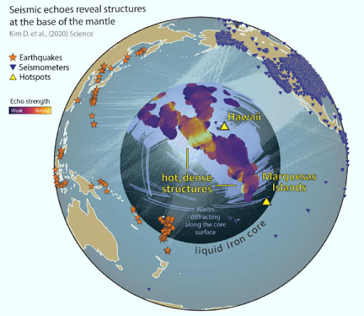
At the interfaces between the ULVZs and the more normal material around them echoes of seismic waves can be produced. In the past these echoes have been difficult to distinguish from random noise but the machine learning algorithm was able to recognize them, adding a lot of detail to the nature of the ULVZs.
According to Doyeon Kim, lead author of the study. “By looking at thousands of core-mantel boundary echoes at once, instead of focusing on a few at a time, as is usually done, we have gotten a totally new perspective. This is showing us that the core-mantel boundary region has lots of structures that can produce these echoes and that was something we didn’t realize before because we only had a narrow view.”

Further refinements for the technique developed by the geologists at the University of Maryland will undoubtedly discover more structures in other sections of the core-mantel boundary while at the same time providing clearer images of those ULVZs already located. Even if the deep interior of the Earth is unreachable to us physically, scientists are still finding ways study it and learn its secrets.