Meteorologists update their estimate for the 2020 Hurricane season. Hold onto your hat, stormy weather’s a headin’ our way.

It was only three months ago, 27May2020, that I published a post discussing how the 2020 hurricane season was shaping up to be a very active one. The official estimates at that time from both Colorado State University’s Tropical Meteorology Project and the National Oceanographic and Atmospherics Administration (NOAA) were predicting around 15-20 named storms with 8-10 becoming hurricanes and 3-5 turning into major hurricanes.
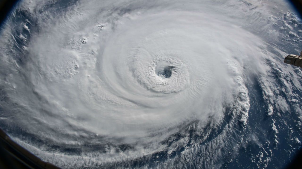
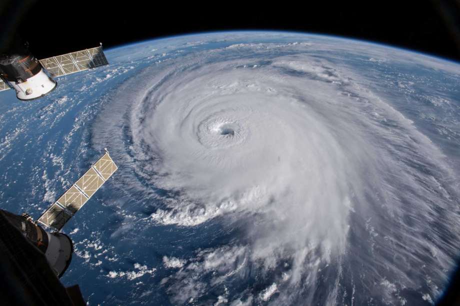
Beautiful but deadly. Hurricane Florence in 2018 as seen from Earth orbit. (Credit: Spectrum News)

Those predictions have already been proven to be conservative. We are still not through August and there have already been 12 tropical storms, five of which have developed into hurricanes. As I write these words Tropical Storm Marco, downgraded from a Cat1 hurricane, has battering the state of Louisiana while hurricane Laura, just upgraded to Cat3, is headed for almost the exact same area of the gulf coast. And the next month and a half is usually the busiest part of the Atlantic hurricane season.
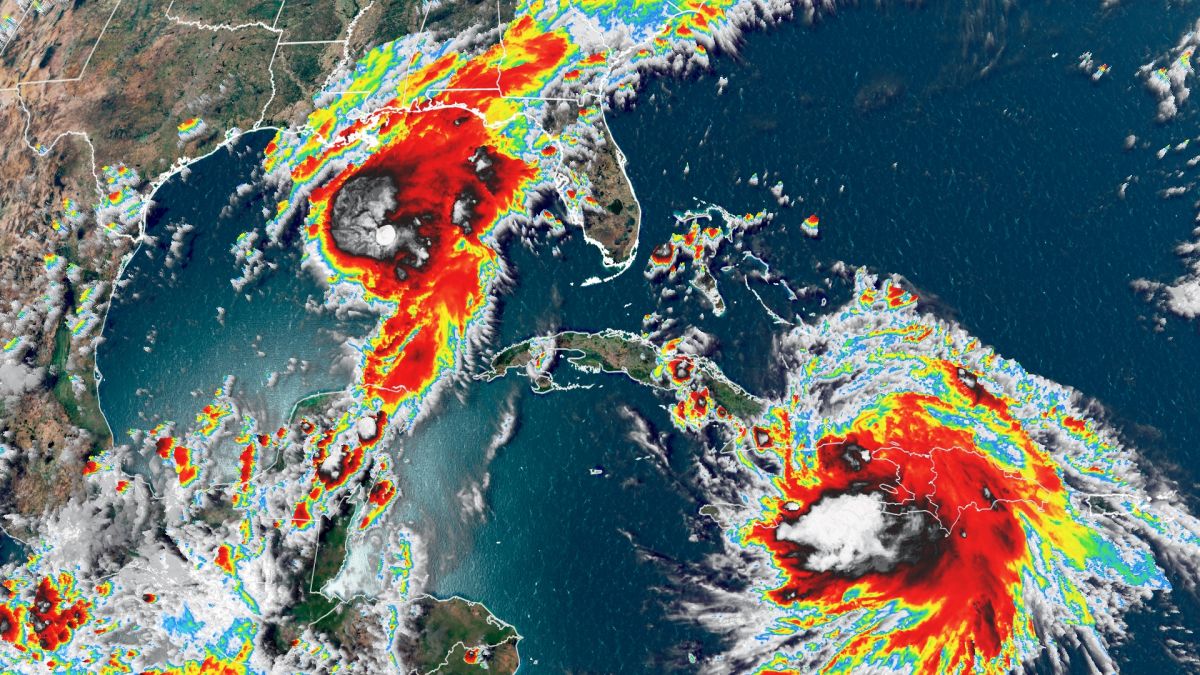
Even as Marco (upper left) dumps rain on the Gulf States Laura is headed towards the very same region for a one-two punch that’s unprecedented. (Credit: CNN.com)

It’s not surprising therefore that the same institutes that made those predictions three months ago have reevaluated their estimates and are now publishing the most dire forecast in the history of hurricane studies. The meteorological team at Colorado State University now estimates that the 2020 hurricane season will consist of 24 named tropical storms of which 12 are likely to become hurricanes with 5 developing into major hurricanes.

If that forecast turns out to be accurate it would make the 2020 season the second most active in recorded history, surpassed only by the 2005 season which saw 28 named storms, including hurricanes Katrina and Wilma. And since hurricane forecasters only select 21 names for storms each year, the letters Q, U, X, Y and Z are not used to name storms, if there are 24 named storms meteorologists will be forced to use Greek letters to identify the last three instead of names, again something that has only ever happened once back in 2005.

So why is this year already so active, and what conditions are the meteorologists seeing that made them redo their forecasts. Well one factor that often inhibits the formation of hurricanes is a strong El Niño in the eastern Pacific Ocean. The strong winds developed by El Niño can produce wind shear that disperse low pressure systems in the Atlantic before they can even develop into tropical storms. This year however there is absolutely no trace of El Niño, a condition that will allow storms to grow unchecked.
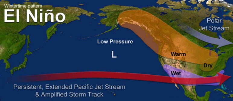
A strong El Nino in the Pacific sends winds into the Atlantic that can break up hurricane’s before they become dangerous. There is no El Nino this year. (Credit: NOAA)

At the same time low-pressure systems moving westward off of North Africa are stronger than usual because of exceptional rainfall amounts in the Sahel region of Africa between the Sahara Desert and the Congo rainforest. This region generates almost 90% of the low-pressure systems that develop into tropical Atlantic storms and this year the excess rainfall is making them particularly intense.
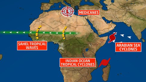
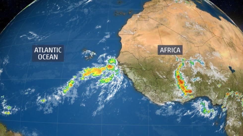
Pressure waves moving west off of the Sahel region of North Africa often grow into Atlantic hurricanes. Sahel waves are especially strong this year. (Credit: The Weather Channel)
Those pressure waves often become the seeds that turn into deadly hurricanes like Laura! (Credit: The Weather Channel)

But of course the biggest factor in generating tropical storms is simply the temperature of the waters of the Atlantic Ocean and Gulf of Mexico both of which are at or even beyond historic levels. Warm tropical waters evaporate more quickly, putting not only more water but more energy into those low-pressure systems coming from Africa, leading to more, and more powerful storms. 
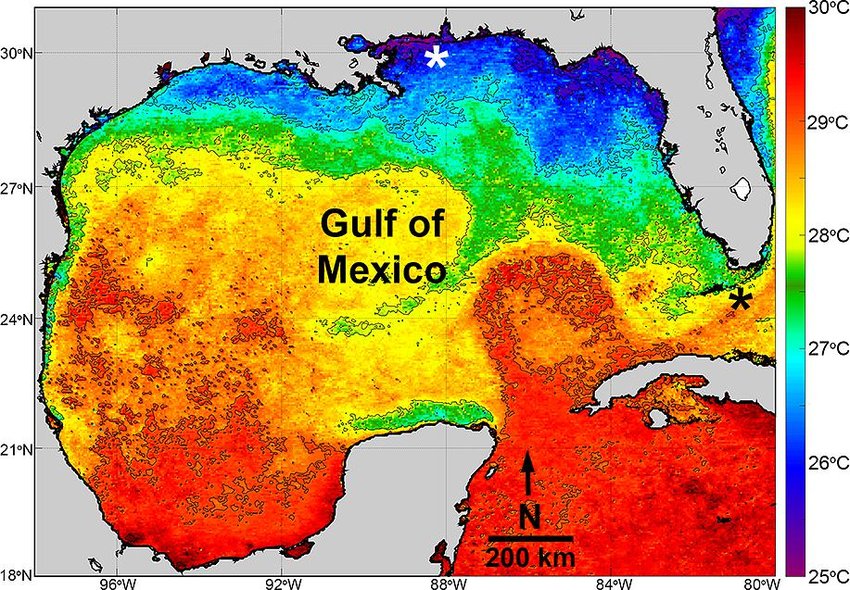
Surface water temperature in the Gulf of Mexico is becoming higher every year thanks to Global Warming! This increase in energy is reflected in more and more powerful Gulf hurricanes. (Credit: ResearchGate)

And what is it that’s making the waters of the Atlantic and Gulf warmer than ever observed before? Well if you haven’t already guessed Global Warming where have you been the last 20 years? Seriously the conditions caused by our continued, reckless emissions of carbon dioxide have grown beyond the point of causing ‘Slightly Higher Averages’ so that now nearly every year is noticeably hotter they were just 20 years ago.

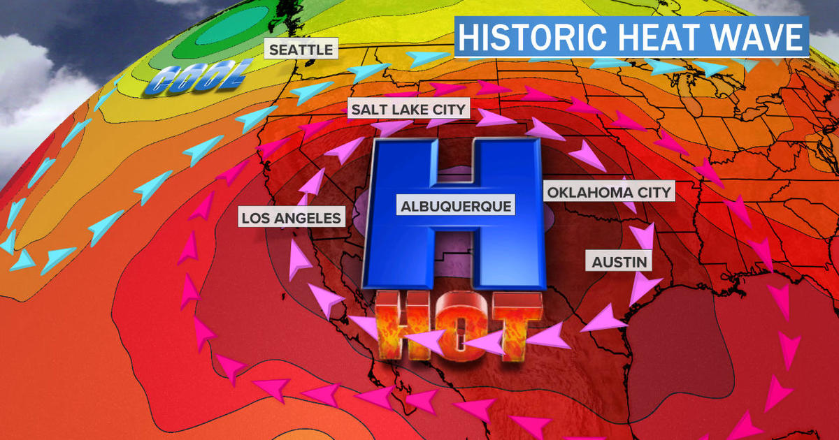
This increase is occurring both globally and locally. For example, here in Philadelphia this past winter we had a very warm winter with no snow accumulation at all and right now we are enduring our 34nd day of +32ºC (+90º F) temperatures, our average is 22 days. The entire west coast of the US is currently suffering through a heat wave on a scale never seen before, hundreds of all time high records are expected to be broken while the wild fire season is already turning out to be especially destructive. In fact the National Weather Service has for the first time ever issued a warning for ‘Fire-Nadoes’, tornadoes generated by the extreme winds in a massive. Meanwhile the temperature in Death Valley was recently measured at 54.4ºC (130º F), the highest reliably recorded temperature ever in the entire world.
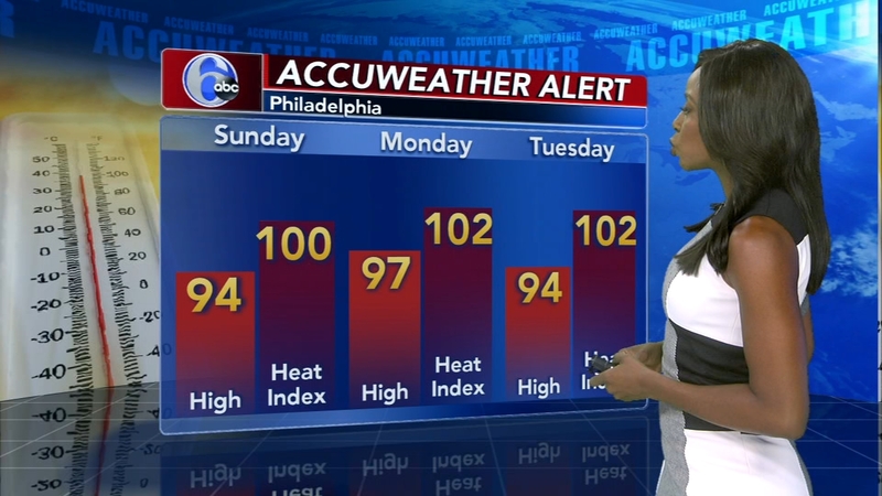
This summer in Philadelphia has been excessively hot, with stronger than normal storms added in. (Credit: 6ABC)
Meanwhile the western US is suffering under an historic heat wave. (Credit: CBS News)

Globally last year, 2019 was the second hottest ever recorded, coming in only slightly below 2016. In fact according to NOAA 9 out of the ten hottest years ever recorded have come in the last 15 years. A team of climatologists working in Greenland have recently announced that, in their opinion the glaciers there are beyond the point of no return. 
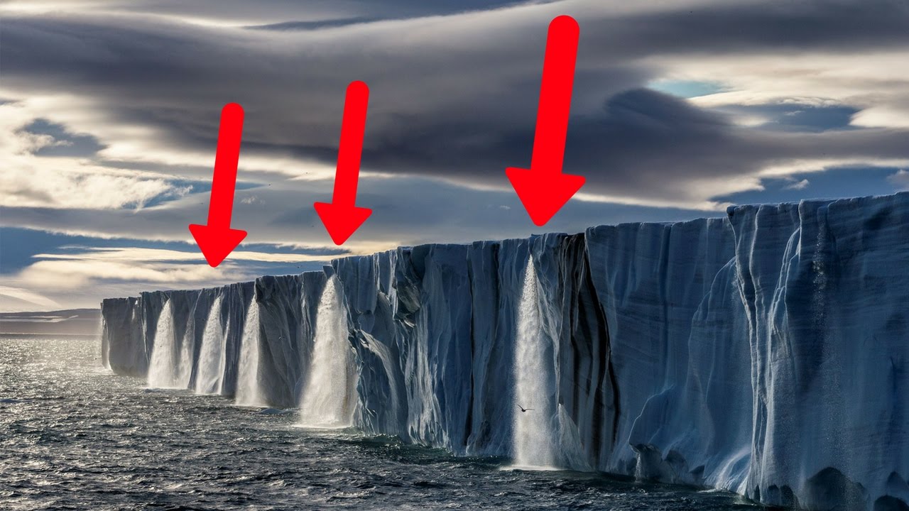
Greenland is melting while we watch, and all of that water is rising sea levels! (Credit: YouTube)

So I guess the question is how much more destruction is the environment going to have to cause before we’ll finally start to pay attention. Personally I’m beginning to fear that even a disaster on the scale of the sinking of Miami might not be enough, after all Katrina and New Orleans in 2005 weren’t. Currently millions of Americans are doing everything they can to ignore the worst epidemic to hit this country in 100 years. I’m almost certain they can find excuses to keep on ignoring climate change even as it’s blowing down their homes!
Hurricanes are growing stronger because of Global Warming.

Hurricane season in the Atlantic doesn’t even start until the first of June but already we have had our first named tropical storm of the year. Over the past week Tropical Storm Arthur formed just south of the Florida Keys and then moved north paralleling the US east coast before brushing Cape Hatteras and finally turning east into the mid-Atlantic. It seems that Arthur is just a preview of what is expected to be a rather active hurricane season.

When viewed from space a hurricane can be a thing of beauty. They’re not so nice up close! (Credit: Houston Chronicle)

This year’s official hurricane forecast, published by the Colorado State University’s Tropical Meteorology Project calls for 16 named storms of which eight are expected to develop into hurricanes with four of those becoming major hurricanes, category 3 or higher. This prediction is about 33% higher than the average number of storms over the last thirty years but slightly below the actual number of Atlantic storms that occurred last year in 2019.

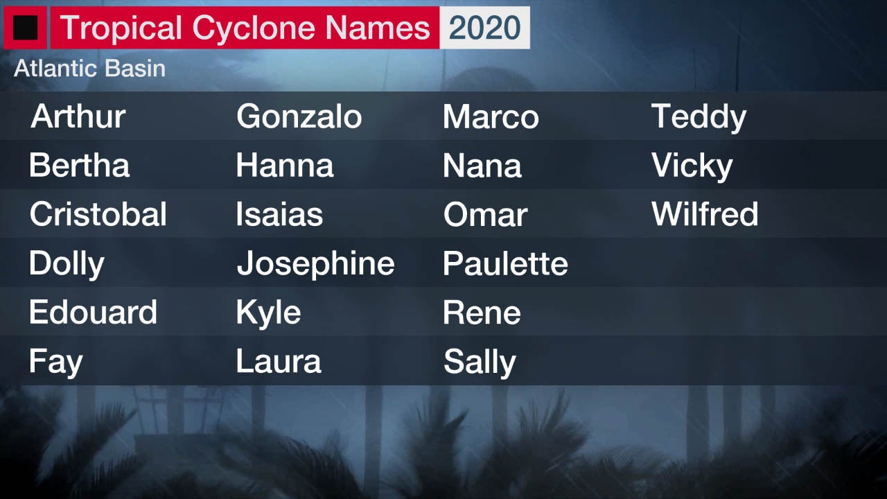
They’ve already got the names selected for this year’s tropical storms and hurricanes. And we’ve already had Arthur! (Credit: The Weather Channel)

And that’s only the Atlantic Ocean. The Pacific Ocean has already seen one massive Typhoon that caused considerable damage to the Philippines while in the Indian Ocean a large cyclone named Amphan has struck near the Indian city of Calcutta with winds of over 160 kph causing major damage and the loss of close to 100 lives.

By the way Hurricanes, Typhoons and Cyclones are all the same general phenomenon, although many of the details of where they normally form and usually go may vary greatly. The only real difference is the ocean they form in and cause their damage.

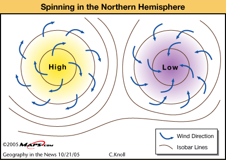
Hurricanes spin because of the Coriolis Effect and high pressure systems, nice weather, spin in the opposite direction of low pressure systems, storms! (Credit: InCarto)

Now a new study from the National Oceanographic and Atmospherics Administration (NOAA) is providing more evidence for the hypothesis that hurricanes and the other kinds tropical storms are slowly getting stronger because global warming. Not each individual storm, they can vary up and down considerably but the average strength of all the storms each year is growing with time.

The National Oceanographic and Atmospheric Administration NOAA operates a fleet of aircraft designed to study Hurricanes and other kinds of weather. (Credit: Slate.com)

(I’d like to take a minute here to discuss the controversy over the terms of Global Warming / Climate Change. There are even some deniers out there have even gone so far as to assert that the fact that scientists use two names is proof that it’s all just a hoax. Well I use both terms but not interchangeably, and here is the reasoning behind my choice of which term I will use in a given circumstance. Greenhouse gasses in our atmosphere are raising the temperature of the Earth’s surface, its oceans as well as its atmosphere. That is a direct effect of the greenhouse gasses that I will refer to as Global Warming. Indirect effects such as stronger storms, droughts and floods I refer to as Climate Change that are caused by Global Warming! Got it, the direct effects of greenhouse gasses are Global Warming while the effects of Global Warming, therefore the indirect effects of greenhouse gasses I call Climate Change!)

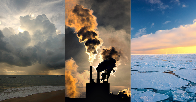
Whether you call it Global Warming or Climate Change the pollution we are dumping into our atmosphere is melting the sea ice and generating stronger storms! (Credit: NASA)

The University of Colorado study was based on data obtained from every Atlantic hurricane over the past 40 years including wind speeds, barometric pressures and storm sizes. Much of the data used in the study, storm size in particular, was obtained from satellite images. According to study lead author James Kossin of NOAA, “our results show that these storms have become stronger on global and regional levels, which is consistent with expectations of how hurricanes respond to a warming world.”

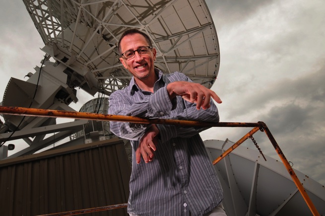
NOAA’s Dr. James Kossin, author of the report on the effect of global warming on hurricanes. (Credit: U-W Madison)

In fact the study details an 8% rise in average storm strength with each decade that has passed. “In other words,” Kossin continued, “during its lifetime a hurricane is 8% more likely to be a major hurricane in this decade compared to the last decade.”

It’s easy to understand how global warming could lead to stronger hurricanes. Warmer air blows at a greater velocity; warmer water evaporates more quickly putting more moisture into those faster winds. In essence warmth is energy and by putting more energy into Earth’s surface global warming is also putting more energy into the storms in Earth’s atmosphere.

So it’s a fair bet that this year’s hurricane season will turn out to be a fraction above average, as will many of the years to come. Then as the decades go by the average will increase until what we now consider an active hurricane season becomes average. And of course when combined with sea level rise, another effect of global warming, those stronger storms can be expected to cause much more damage.

Hurricane season starts soon. Are you ready? (Credit: Daily Express)

Just one more way in which global warming is making our future look uncertain and bleak.

P.S. I barely managed to publish this post when I saw a weather report that tropical storm Bertha has formed off of the South Carolina coast. That’s two named storms and it’s still another four days BEFORE hurricane season ‘officially’ starts!

The Coriolis “Force”, it’s what makes Hurricanes, Tornadoes and the water in your Toilet spin.

Did you ever take a ride on a Merry-Go-Round with a friend and while the ride was spinning you tried to toss something, let’s say a piece of candy to them? Well I bet the candy took off in a sharp turn and you missed by a mile! You’re left with a surprised look on your face as the candy flies off as if it had a mind of its own!

Think about it, because of the motion of the Merry-Go-Round both you and your friend are moving in a circle! That means that by the time the candy gets to where your friend was when you threw it, they’re not there anymore! And because of the circular motion of the Carousel your candy appears to you to take a sharp turn in the opposite direction of the spin of the Merry-Go-Round! Click on the link below to be taken to a youtube video of a very nice demonstration of what I’m describing from a freshman physics course at MIT.

This effect is commonly known as the Coriolis “Force” although any physicist will point out that there’s really no force acting on the candy. Technically what’s happening is that you are in a rotating frame of reference, the Carousel, but once you let go of the candy it no longer is. This makes the candy’s straight line motion look to you as if it’s curved. That’s right the candy is moving in a straight line, you’re on the Merry-Go-Round, you’re the one going in a circle!

Now we all live our lives on a great big Merry-Go-Round, better known as the spinning globe of the Earth, so the coriolis effect has a major influence on many of the phenomena we see every day. (That’s right you flat Earth loonies, the Earth is a spinning globe and the phenomena I’m about to talk about are demonstrations of that fact!!!). Since the Earth’s equator is 40,000 km in circumference and the planet rotates once every 24 hours that means that a person standing on the equator is actually moving at 1666.6 kilometers per hour (40,000km / 24 hours=1666.6 kph). On the other hand someone standing at the north or south pole isn’t moving at all (relative to the center of the Earth at least) but simply turning around once every 24 hours. In between you can calculate your speed if you know your latitude using the formula:

v=1666.6 x sin(Latitude)

For example I live in Philadelphia at a latitude of 40º N so I’m moving at a speed of 1071 kph. The image below illustrates this.

Your speed due to the Earth’s spin depends on your latitude.

This difference in velocities has a major effect on our weather and to see how let’s look at how a LOW pressure system behaves. Now I hope you remember that a low pressure system is also a storm system because it pulls in and condenses moisture laden air leading to rain and strong winds.

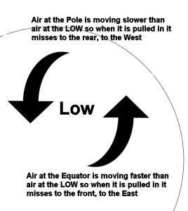
Looking at the image below we see that a super strong Low Pressure system is sitting right over me in Philadelphia. This low is so strong it’s pulling in air all the way from the equator and the north pole. Now as I said above Philadelphia is moving at 1071 kph and so is the air above it. The air at the equator is moving much faster however, 1666 kph so when it get pulled toward the low it misses, going in front of the low, to the east. The air at the pole however is moving much slower so it misses the low to the rear, the west. The result is a counter-clockwise flow of air around the low pressure system giving hurricanes and tornados their familiar spiral shape, see image of a hurricane below. That is why you often hear your local meteorologist, in the northern hemisphere, talk about storms having a counterclockwise motion while a fair weather system has a clockwise spin.

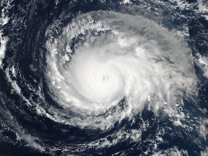
Hurricane Irma Spinning Counter-Clockwise (Credit: National Geographic)

The mirror image of this happens in the southern hemisphere. The air from the equator still misses to the front of the low and the air from the pole misses to the rear but because the equator and pole have flipped positions, see image below, the low now has a clockwise flow. The very movements of the weather systems on Earth are due to our planet being a spinning globe.

Before I go I’ll mention one more example of the coriolis effect that you probably see several times a day, whenever you flush your toilet in fact. Think about it, isn’t all that water flowing out causing a low pressure system, and doesn’t the water spin counter-clockwise north of the equator and clockwise south of it. That’s the coriolis effect right inside your own home.

And you don’t have to be very far north or south of the equator to see the spinning. Click on the link below to be taken to a youtube video shot at the equator in Uganda. The presenter demonstrates the coriolis effect just a few feet north of, right on and a few feet south of the equator.

https://www.youtube.com/watch?v=_xqtXBnuXiA

So remember, the next time some you arguing with a flat Earth idiot just flush the toilet and tell them the spinning globe of the Earth is causing the spin in the water. Then you can flush their nonsense down the toilet as well.


Is Global Warming Responsible for the Increased Number and Strength of Hurricanes?

The hurricane season for 2017 is just past its half way point and already this year has proven to be abnormally deadly and destructive. Hurricane Harvey inundated southeast Texas with over a meter of rain while Hurricane Irma wrecked several Caribbean Islands before causing a trail of destruction the length of the Florida peninsula. By some measurements Irma was the strongest Atlantic storm ever seen, remaining a category five storm longer than any on record with the second highest wind speed ever measured. For a short time both Irma and Jose were cat 5, the first time ever two such powerful storms have existed at once. Plus, I just heard on the news that Jose has now been officially a hurricane longer than any storm on record.

Even now there are three powerful storms in the Atlantic. Jose has been downgraded to a cat 1 but is still a possible threat to the US east coast. Maria has strengthened to a cat 5 and is expected to strike Puerto Rico today and then perhaps hit the Carolina coast. Finally there is tropical storm Lee, so far out in the Atlantic we don’t yet know what it’s going to do. And hurricane season still has two months to go! The picture below is Irma taken from space and while beautiful you can still feel something of its power in the image. By the way, the small brown object to the left of the storm is Puerto Rico giving an idea of just how big this storm was.

Hurricane Irma from the Space Station (Credit: NASA)

The number and destructive power of these storms force us to ask the question, could global warming be responsible? Has all the carbon dioxide and methane we’ve been pouring into the atmosphere increased storm activity in the Atlantic?

First of all there is simply no doubt that carbon dioxide and methane are greenhouse gasses. Any college freshman chemistry lab is capable of making the necessary measurements. I know that because I did it way back in the 1970s!

Secondly, we know with great accuracy the amount of those gasses that are produced by our burning fossil fuels in our vehicles and power plants. Yes, I know the Earth’s atmosphere is huge but over 30 trillion kilograms of pollution every year is also an enormous amount, many cities throughout the world have smog problems and air pollution is a major health concern.

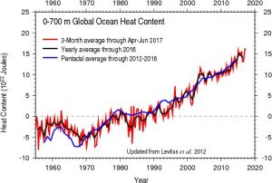
Thirdly, we can measure the rise in temperature over the last 50 years of the atmosphere, 0.6 degrees Celsius, and the oceans, 0.32 degrees. While these may seem like at small changes when you consider the world’s oceans it is simply an enormous amount of energy. The graph below from the National Oceanographic and Atmospheric Administration (NOAA) shows the increase in the amount of energy in the Oceans due to global warming. The total amount is about 15×1022 joules but to give you an idea just how much energy that is it’s more than the energy in 35 million one megaton nuclear bombs. That’s right, the increase in energy is more than 35 million nuclear bombs!!!

Increase in Oceanic Heat Content (Credit: NOAA)

So even if only a small fraction of that energy increase gets into the storms that form over the oceans it would certainly be enough to significantly amplify the number and power of those storms. So, what are the numbers? Has there been an increase in the number of tropical storms and hurricanes in the Atlantic?

The table below shows the average number of both tropical storms and hurricanes as a function of decade for the 1970s, 80s, 90s, 2000s along with 2010 to 2016. The obvious increase is between the 1990s and 2000s, a more than 40% increase but the increase from the 80s to the 90s is not insignificant. Now, climatologists like to look at long term trends, to them even a decade is a short period of time. Nevertheless over the last 16-17 years there has been an undeniable increase in both the number and strength of Atlantic storms.

Yearly Average of Tropical Storms in decades (Credit: R. A. Lawler)

Now I’ve only been talking about tropical storms in the Atlantic. The Pacific Ocean has also seen an uptick in activity along with an increase in tornadoes across North America and just an increase in rainfall in general throughout the world. All this is a strong indication that global warming is causing more powerful, more violent weather everywhere.

The time is past for debates, the effects of climate change are already upon us. There’s much worse to come unless we seriously reduce the amount of polluting gasses we generate. Sea level rise combined with increased hurricane activity could soon lead to much greater destruction than we’ve seen so far. Quick and decisive action is required before it’s too late.