Eruption at Krakatoa causes Tsunami killing hundreds along coast of Indonesia. Is there more to come?

The island nation of Indonesia is generally considered to be the most volcanically active country in the world. Lying right on the so-called ‘Ring of Fire’ the nation is dotted with some 130 known active volcanoes. Probably the most famous of Indonesia’s volcanoes is Krakatao, a name that has almost become a byword for volcanic destruction. See image below.
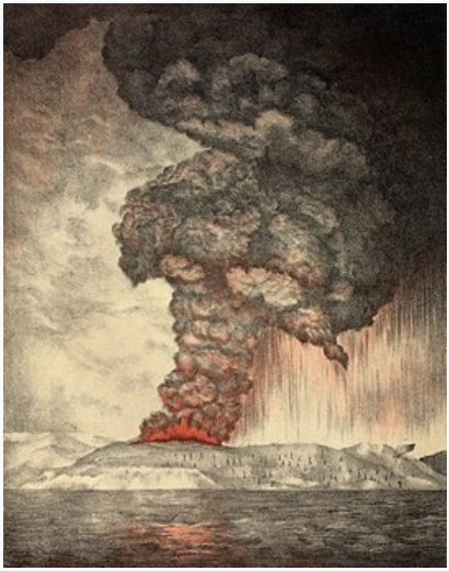
Artist’s Impression of the 1883 Eruption of Krakatoa (Credit: Public Domain)

For thousands of years the Krakatoa volcano sat on a small, uninhabited island between the much larger, and heavily populated islands of Java and Sumatra, see image below. The volcano had a long recorded history of eruptions until during the night of 26-27 August of 1883 the Krakatoa volcano exploded with a force of about 200 megatons, four times that of the largest nuclear weapon ever tested. It is estimated that the eruption of 1883 ejected approximately 25 cubic kilometers of rock into the atmosphere destroying the island on which the volcano sat while generating a Tsunami that killed over 36,000 people along the coasts of Java and Sumatra.
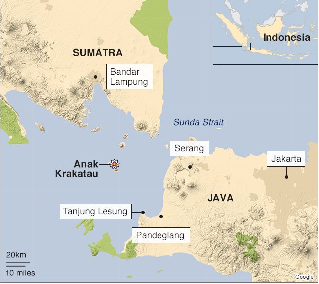
Position of Krakatoa (Modern Anak Krakatoa) between Java and Sumatra (Credit: Google)

After that eruption Krakatoa was quiet for a few decades but starting in the 1920s the pressure began to build again and a new island, with a new volcano lifted itself out of the water. Named Anak Krakatoa or child of Krakatoa, see image below, the volcano has been growing steadily at a rate of 13 centimeters a week over the last few decades. The continuous activity of Krakatoa, and its potential to generate further natural disasters has alarmed both geologists and the Indonesian government.
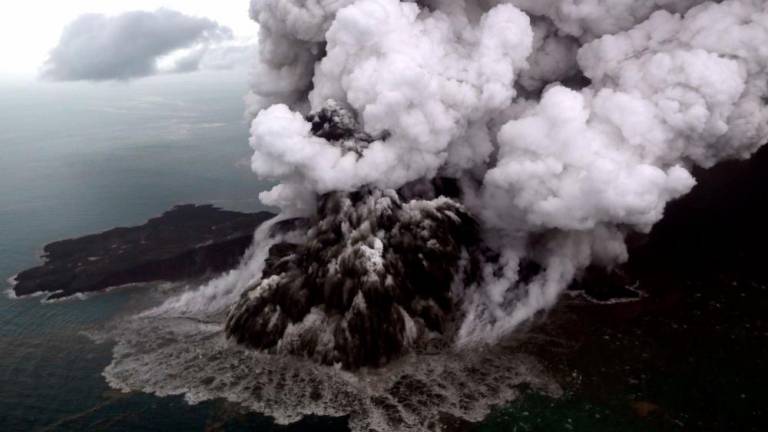
Recent Eruptions of the Anak Krakatoa Volcano have triggered a tsunami spreading destruction across Indonesia (Credit: The Sun Daily)

Just this past week the seismic activity of Krakatoa has again proved deadly as new eruptions on the night of 22 December generated a Tsunami wave as high as 5 meters that struck several villages and tourist resorts on the western end of the island of Java. Unlike the Indonesian tsunami of 2004 that killed a quarter of a million people this tsunami does not appear to have been caused by an underwater earthquake but rather by a landslide of part of the volcano into the ocean, see image below.
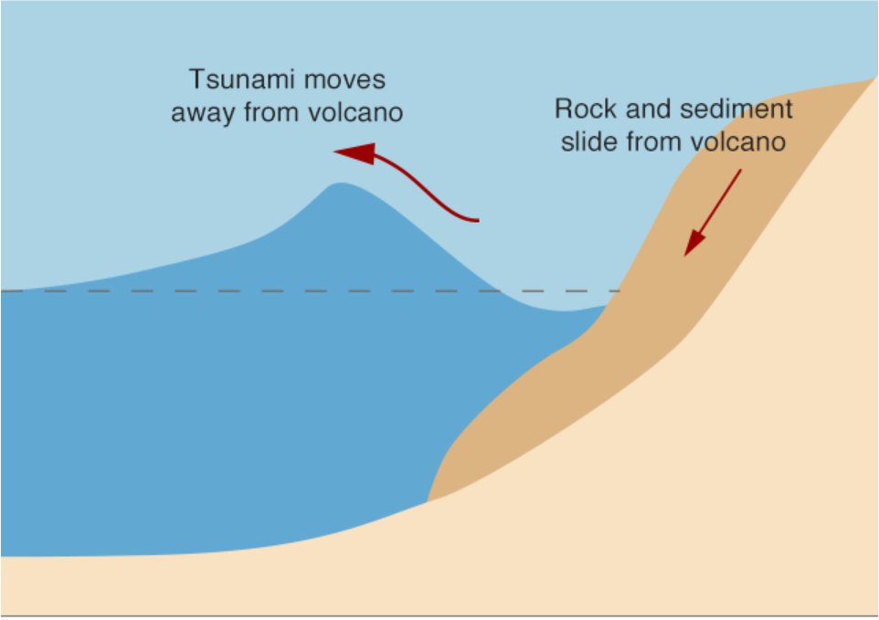
Tsunami Caused by Landslide (Credit: University of California, Santa Cruz)

Now you might wonder what difference a landslide makes compares to an earthquake but it turns out that Indonesia’s tsunami warning system is designed to detect earthquakes and missed the landslide completely. Because of this there was absolutely no warning of the waves that have killed at least 400 and wounded several thousand. Another problem is that, since the island formed by Anak Krakatoa is so close to the Java shore even if the tsunami detection system had worked it would have only provided a minute or two of warning to the people in its deadly path.
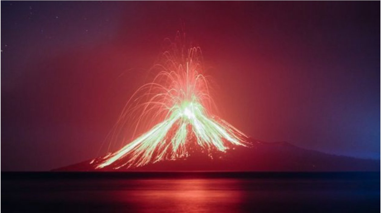
Eruption of Anak Krakatoa back in July (Credit: Getty)

The recent seismic activity by the Krakatoa volcano will undoubtedly continue, indeed it is very likely to intensify rather than decline. Because of that the deadly eruptions of this past week are certain to have sequels. The people of Indonesia know very well of dangers that come with living in the most geologically active country on Earth. They can only hope that better detection systems based upon more a more comprehensive understanding of the mechanisms of volcanism will allow them to live safer lives in the shadow of Krakatoa.

Volcanic Eruptions in Hawaii and Guatemala, Why are they so Different?

One of the biggest news stories over the last month has been the continuous eruption of the Kilauea volcano on the big island in Hawaii. Now Kilauea has actually been quietly erupting for the past fifty years but recently the amount and intensity of the lava flow has increased by more than an order of magnitude.

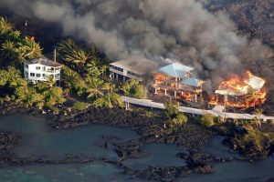
More than twenty new fissures of the volcano have opened destroying hundreds of homes. At the same time, although no one has been reported to have died thousands of people have been forced to flee to safety. The images below show some of the power of the Kilauea volcano.

Eruption of Kilauea (Credit: UK Express)
Destruction of Kilauea (Credit: Newsweek)

Now just four days ago in the Central American nation of Guatemala the Volcan de Fuego, that’s Spanish for the Volcano of Fire, erupted sending a torrent of hot ash and mud through surrounding villages. This landslide of material is technically known as a pyroclastic flow and is the same phenomenon that buried the ancient Roman town of Pompeii.

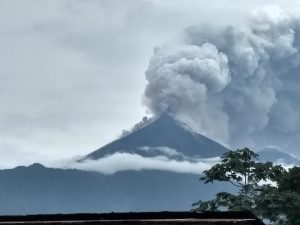
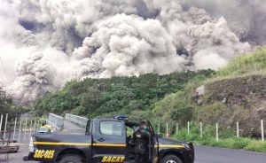
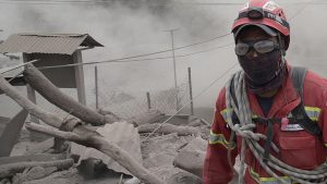
Within minutes of the eruption in Guatemala hundreds were either dead or missing and thousands left homeless. The images below show some of the destruction cause by the Volcan de Fuego.

Volcan de Fuego (Credit: Clarin)
Pyroclastic flow from Volcan de Fuego (Credit: El Universal)

So what’s the difference here? The power of both volcanoes is inexorable; all that we humans can do is just run away until the volcano calms down as they always do. Still the lava flow from Kilauea has been steady, measured. So much so that you can almost walk to safety.

The ash flow from de Fuego however was like a tsunami, so fast that many people were engulfed before they knew what was happening, so fast that cars sometimes could not keep ahead of it.

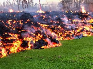
The volcanic material from the two volcanoes even looks completely different. The lava from Kilauea is the classic molten red liquid that cools to a pitch-black hard rock. The material from Volcan de Fuego on the other hand is a gray powder that coats and chokes everything. The images below show the differences in the material coming from the two volcanoes.

Lava from Kilauea moves slowly (Credit: USA Today)
Ash Produced by Volcan de Fuego (Credit: Lavanguardian)

How can they be so different, they are both volcanoes aren’t they? Yes, they are both volcanoes but there are profound differences between them, and those differences can teach us a great deal about our planet. Kilauea is the simpler to describe and understand so I’ll start with it.

Kilauea, and all of the volcanoes that formed the Hawaiian island chain sit on a hole in the Earth’s crust that allows material from deep down to rise to the surface. Technically known as a ‘Hot Spot’ this hole reaches into the mantel, or even deeper, where the material is both hotter and more thoroughly mixed. Because of this smooth consistency volcanoes like Kilauea do not get clogged, they tend to spew out some lava all of the time.

Another thing to remember about Hot Spots is that they don’t move with the Earth’s tectonic plates. That’s how the Hawaiian island chain was formed as the Pacific plate slide across the Hot Spot forming new volcanoes, i.e. new islands as the plate shifted. So Kilauea is not caused by plate tectonics.

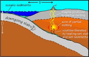
On the other hand Volcan de Fuego is a product of plate tectonics, it is directly generated by the movement of the North American plate over the Pacific plate. As the material of the Pacific plate is subducted beneath the North American it pushes upward spawning mountains and volcanoes. It is this mechanism that has produced the so-called ‘Ring of Fire’ around the Pacific Ocean. The image below illustrates how such a subduction zone works.

Diagram of Subduction Zone (Credit: Oregon State University)

However the material that rises up through volcanoes like Volcan de Fuego doesn’t come up as consistently as it does from a Hot Spot. This means that these volcanoes can go dormant for years or even decades. During this dormancy the volcano dome and lava chamber can harden and when pressure again starts to build the dome becomes a cap and the pressure just builds until it explodes destroying everything for kilometers in a matter of minutes. This is what happened at Vesuvius in 86CE, at Mount St. Helens in 1980 and happened at the Volcan de Fuego this week.

Kilauea and Volcan de Fuego may appear very similar above ground but by studying their differences we have learned a deeper truth about the forces that created them.


Volcanic ‘Hotspot’ that formed the Hawaiian Islands moved about 50 Million Years Ago.

Geologists have learned a great deal in the last fifty years about the mechanics of how volcanoes are created and operate. According to the modern theory of ‘Plate Tectonics’ the surface of the Earth consists of a number of hard plates that ride over our planet’s softer, more fluid mantel. These plates move around the surface of the earth very slowly with time. As the plates move they can either pull apart from or collide into each other and those are the areas of the Earth where seismic activity like earthquakes or volcanoes normally occurs.

Normally, but not always, the volcanoes that have formed the Hawaiian Islands are a major exception to this model. Geologists have recognized the existence of a stationary ‘Hotspot’ in the Pacific Ocean that is presently feeding the active volcano of Kilauea on Hawaii’s big Island.

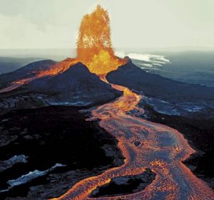
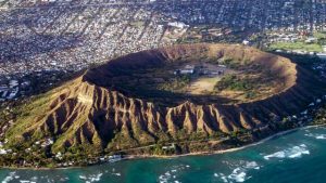
The Kilauea volcano is only about half a million years old however and before then the hotspot generated the now extinct volcanoes of Mauna Kea, Diamond Head and all of the other volcanoes of the Hawaiian chain. The images below show Kilauea and Diamond Head.

Kilauea Volcano (Credit: Milliyet.com)
Diamond Head extinct Volcano (Credit: lexpress.fir)

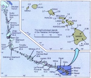
In fact, as the Pacific Tectonic Plate has moved northwestward over the last 70 million years the hotspot has generated a long series of now extinct volcanoes known as the Hawaiian-Emperor chain. Most of these volcanic peaks have now dropped back below the surface of the ocean but the entire chain stretches in a straight line from Kilauea almost to the Aleutian Islands. The illustration below shows what the Hawaiian-Emperor chain would look like if the water of the Pacific Ocean were removed.

Hawaiian Emperor Volcano Chain (Credit: Earth Science)

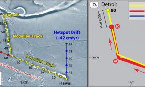
Recently more accurate underwater mapping of the Hawaiian-Emperor chain has led researchers at the GFZ Research Center for Geosciences in Germany to conclude that the Hawaiian-Emperor chain may not be as straight as was thought. According to the scientists at GFZ about 47 million years ago the chain took a temporary bend to the left, as seen from Hawaii, an indication that the hotspot had moved several dozen miles to the south over the course of around a million years. The image below shows the bend identified by the geologists.

Bend in the Hawaiian-Emperor Hotspot (Credit: T. Torsvik, GFZ)

“If you try to explain this bend with just a sudden change in the movement of the Pacific Plate.” Says Bernhard Steinberger a researcher at GFZ. “You would expect a significantly different direction of motion at that time relative to adjacent tectonic plates. But we have not found any evidence for that.”

The scientists also checked the position of the Hawaiian hot spot against two other hot spots, the Rurutu volcanic chain in the western Pacific and the Louisville chain in the southern Pacific. The results indicate that it was the Hawaiian hotpot that moved some 50 million years ago.

The geologists at GFZ will continue to study the movement of the Hawaiian hotspot. “With more field data and information about the processes deep in the mantel, we hope to explain in more detail how the bend in the Hawaiian-Emperor chain has evolved.” Steinberger said.

The more we learn about volcanoes the better we will be able to understand how the Earth itself works. I look forward to hearing more from the GFZ Research Center for Geosciences about their work on the Hawaiian hotspot.